Subject: Southwestern United States
Period: 1857 (dated)
Publication: Sen. Ex. Doc. No. 11 & Ho. Ex. No. 2, 35th Congress, 1st Session
Color: Black & White
Size:
30.9 x 20.1 inches
78.5 x 51.1 cm
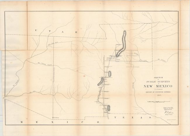
Early, large-scale, territorial map by the Surveyor Generals Office, Santa Fe, New Mexico. It includes all of today's Arizona and extends to include portions of eastern California and southern Utah to the north. The area of present-day New Mexico is depicted with limited surveying, primarily the settled areas of Santa Fe and along the valley of the Rio Grande River. Place names includes Meslia, Cruces, Ft. Filmore, Ft. Thorn, San Felipe, Algodones, Cochiti, and more. The region to the west of the Rio Grande is void of detail except for a few rivers and a proposed meridian at Fort Buchanan.
References:
Condition: B
Issued folding and now flattened and backed with tissue to repair a few tiny splits at fold intersections. There is light toning along the folds, minor foxing, faint offsetting, and a small piece of archival tape in the top left corner of the image on recto.