Subject: World
Period: 1710 (circa)
Publication:
Color: Hand Color
Size:
11.8 x 8.7 inches
30 x 22.1 cm
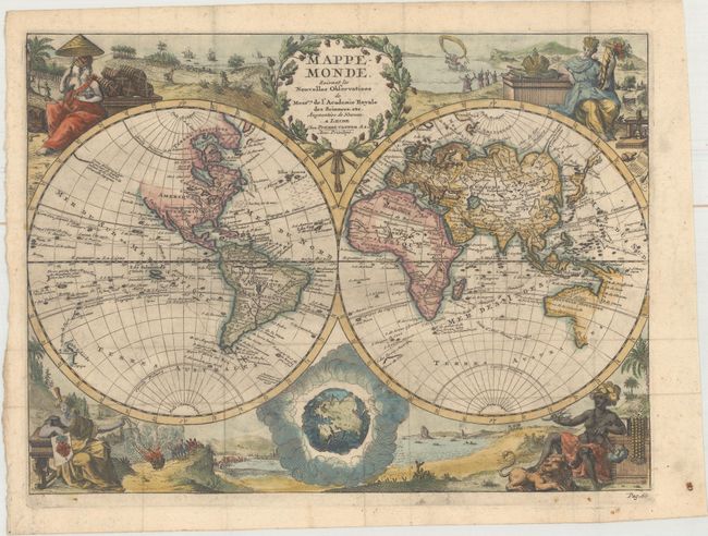
Vignettes symbolizing the four continents fill the corners of this uncommon, double hemispheric world map. The title cartouche at top is balanced with an interesting representation of the world as it would be seen from space. The map traces the routes of several sixteenth century explorers in the Pacific and Indian Oceans, including Magellan, Tasman, Chevalier de Chermont, Mendana and others. The western coastline of New Zealand is illustrated, along with parts of Australia and Tasmania. Above the peninsular California, the entire northwest coast of North America is blank. There is a remnant of the coastline that suggested a connection between North America and Asia on earlier maps, here with a notation concerning the discoveries of Vasco de Gama. The eastern coast of Asia is truncated and a huge Terre d'Yeco forms the northern part of Japan.
References:
Condition: B+
Issued folding, now flattened, with light soiling and printer's ink residue.