Subject: Colonial North America
Period: 1702 (circa)
Publication: Geographie Universelle
Color: Black & White
Size:
6.7 x 5.4 inches
17 x 13.7 cm
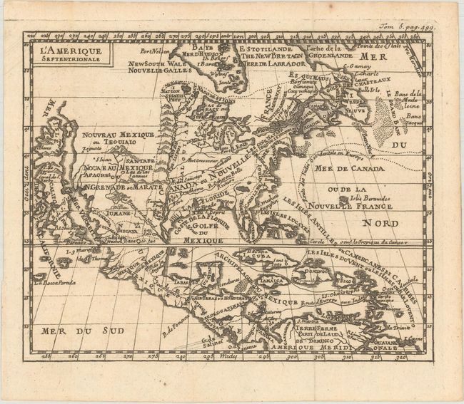
This is a charming small map that shows the island of California with an indented coastline and includes place names Estiete, C. Blanco, P. de Carinde, Canal de S. Barbe, S. Martin, I. de S. Mare, S. Francisco, S. Simon, and an island named La Rocca Partada. The Rio Bravo ou de Nord (Rio Grande) joins the prominent Mississippi River just before emptying into the Gulf of Mexico, much too far west. The incorrect mapping of the Mississippi River was repeated on maps for two decades until Delisle's mapping took precedence. The error was likely La Salle's poor measurement of latitude at the mouth of the Mississippi River in 1684, placing it nearly 190 miles to the south of the correct location. Since the eastern Gulf was far better known at the time, the river (and French claims to Spanish territory) were moved west into present-day south Texas. The cartography is based on Daniel de la Feuille.
References: McLaughlin #145.
Condition: A
A superb impression with one tiny spot in the upper margin, well away from the map, and some spots on the verso.