Subject: References
Period: 1987-2005 (published)
Publication:
Color:
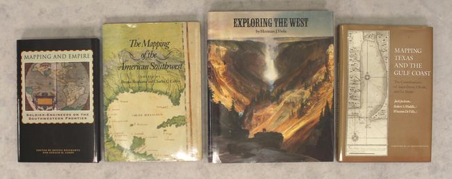
A. Mapping and Empire - Soldier-Engineers on the Southwestern Frontier, by Dennis Reinhartz and Gerald D. Saxon, published 2005, printed color (6.3 x 9.3"). This illuminating reference focuses on the efforts of Spanish, Mexican, and American military cartographers as they attempted to delineate political boundaries in today's American Southwest from the 16th to the mid-19th century. Their work was a crucial step in empire building and helped paved the way for their fellow countrymen also settling into the region. It features an introduction by Richard V. Francaviglia and essays from historians W. Michael Mathes, David Buisseret, Dennis Reinhartz, Ralph E. Ehrenberg, Gerald D. Saxon, Paula Rebert, and John R. Hebert. Reinhartz and Saxon edited the work. The history described is brought to life through 52 black & white illustrations and 12 color plates. Hardbound in red cloth with gilt title on the spine and an illustrated dust jacket. 204 pp. Conditon: Negligible shelf wear, otherwise like new. (A)
B. The Mapping of the American Southwest, by Dennis Reinhartz and Charles C. Colley, published 1988, printed color (7.4 x 10.3"). A very interesting documentation of the history of the different phases of Spanish and French mapmaking of the region with special attention paid to the disputes of boundaries and the various inaccuracies sometimes published as fact. Wonderfully illustrated with 22 uncolored and 7 colored plates. Signed by Mr. Reinhartz. (7.4 x 10.3"). 8vo, hardbound with decorative gilt on cover and gilt title on spine, with illustrated dust jacket. 83 pp. Condition: Contents fine. Covers have a few minor indentations and has a small nick at bottom that can also be seen on the dust jacket. (B+)
C. Exploring the West, by Herman J. Viola, published 1987, printed color (9.3 x 11.2"). Nice book with the accounts of the soldiers, geologists, surveyors, engineers, naturalist, and cartographers who opened the West. It includes Zebulon Pike, Jedediah Smith, Joseph Walker, Kit Carson, John Wesley Powell, Fremont, and many others. Lavishly illustrated with full color plates and black-and-white photographs. Hardbound in brown cloth with illustrated dust jacket. 256 pp. Condition: Contents and covers near fine with just a hint of sunning along the spine. The dust jacket has very minor wear. (A)
D. Mapping Texas and the Gulf Coast - The Contributions of Saint-Denis, Olivan, and Le Maire, by Jack Jackson, Robert S. Weddle, and Winston De Ville, published 1990, black & white (7.3 x 10.3"). A study of 18th century cartography along the Gulf Coast that reveals the complexities of the rivalry between Spain and France. This work provides new insight into the mapping of this region. Seventeen uncolored plates, many previously unpublished. First edition. Written by Jack Jackson, Robert S. Weddle, Winston De Ville. Hardbound in brown cloth, dust jacket., 92 pages. 8vo. Condition: Contents very good with light scattered foxing on the end papers and the edges of the sheets. Covers fine. The dust jacket also has light scattered foxing and a hint of sunning. (B+)
References:
Condition:
See description above.