Subject: Western Hemisphere - America
Period: 1790 (dated)
Publication:
Color: Hand Color
Size:
23.9 x 19 inches
60.7 x 48.3 cm
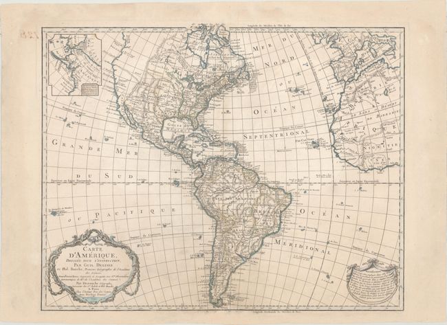
This is a later, updated edition of one of the most popular maps of the 18th century. It was first issued by Delisle in 1722 and went through 19 different versions according to Tooley. This edition was issued by Dezauche, the successor to the Delisle cartographic firm, and has been extensively updated through numerous revisions. The map includes the information from Cook's discoveries in the Northwest and Alaska in an inset "Supplement a la Partie Nord Ouest de l'Amerique d'apres les Decouvertes du Capitaine Cook." The newly independent United States extends to the Mississippi River in the west and to Florida in the south, with the unorganized Louisiana Territory not reaching the Pacific coast. The map shows a number of spurious mountains ranges in the West, going east to west and north to south, and sometimes doing both within the same range. A garland style title cartouche and another cartouche containing an advertisement decorate the lower corners. In this edition, the Privilege is changed from "du Roi" to "d'Auteur." Due to the French Revolution the Royal arms were erased from the cartouche and replaced by ribbons, and the king's name was removed from the title.
References: Tooley (Amer) p.16, #13
Condition: B+
Watermarked paper with original outline color that has been partially refreshed. There is very light soiling and professional repairs confined to the bottom centerfold and the blank margins.