Subject: Caspian Sea
Period: 1753 (dated)
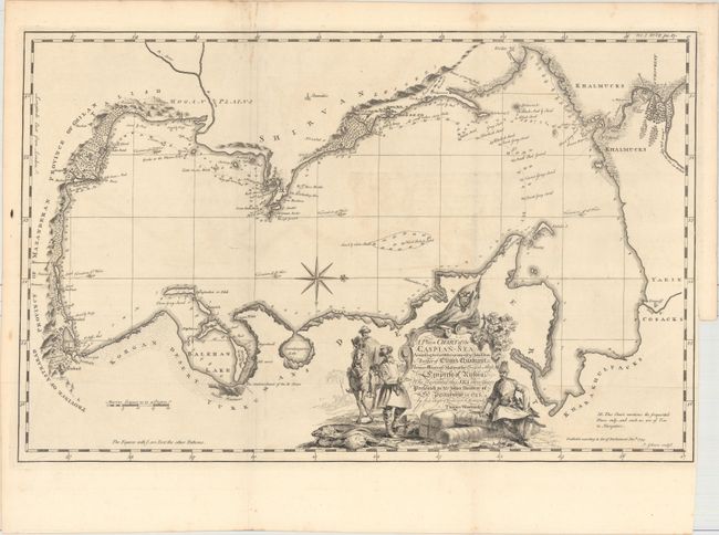
Publication: Historical Account of British Trade Over the Caspian Sea...
Color: Black & White
Size:
21.4 x 13.8 inches
54.4 x 35.1 cm
This uncommon and striking map centers on the Caspian Sea. There is navigational information, including soundings, anchorages, and bottom types, in the sea, and along the shores, there are plenty of place names and nice topographical detail. The map is adorned with a decorative title cartouche at bottom that feature traders in regional dress. It was published in by Jonas Hanway in Historical Account of British Trade Over the Caspian Sea..., a work chronicling the exploration of the Caspian lead by Captain John Elton. The goal of Elton's mission was to open up new routes to trade with Asia. One of Elton's seafarers, Thomas Woodroose, drew this map. Engraved by John Gibson.
References:
Condition: B+
Issued folding on watermarked paper with light offsetting and a few spots of foxing primarily in the blank margins. There is a binding trim at lower right.