Catalog Archive
Auction 161, Lot 595

"Nouvelle Carte Geographique de la Mer d'Asof ou de Zabache, & des Palus Meotides...", Visscher, Nicolas

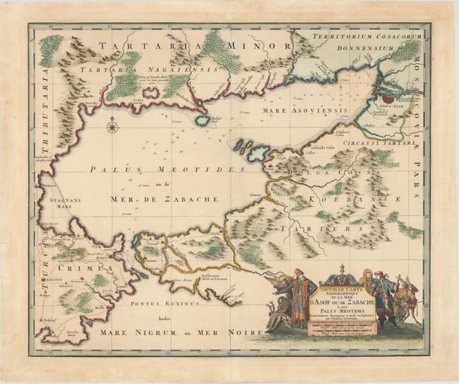
Subject: Sea of Azov

Period: 1696 (circa)

Publication:

Color: Hand Color

Size:
22.9 x 19.2 inches
58.2 x 48.8 cm
Download High Resolution Image
(or just click on image to launch the Zoom viewer)

This rare chart of the Sea of Azov and the surrounding area was published around the time of the Azov Campaigns, in which Peter the Great led two Russian military campaigns to capture the important Turkish port city of Azov. The Russians were successful, and were finally able to reach the Sea of Azov and the Black Sea in their attempt at becoming a maritime power. The city of Azov is prominently depicted at top right. The map is handsomely adorned with a title cartouche featuring several Russian figures and deer hunters.

References:

Condition: A

A crisp impression with professionally repaired centerfold separations at top and bottom and a hint of toning.

Estimate: $500 - $650

Sold for: $350

Closed on 2/8/2017

Archived