Subject: Hispaniola
Period: 1749 (circa)
Publication: The English Pilot. The Fourth Book...
Color: Hand Color
Size:
23.3 x 18.7 inches
59.2 x 47.5 cm
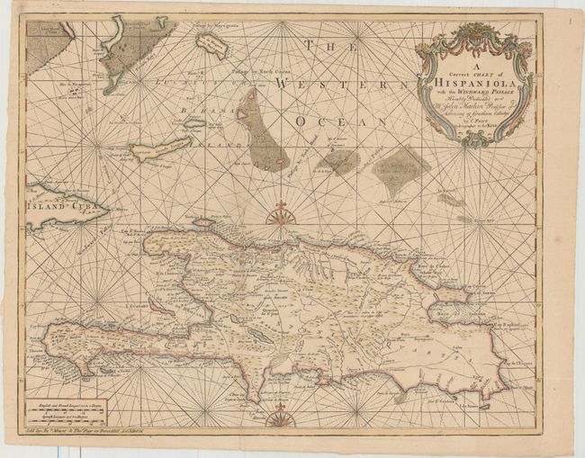
This map is based on Delisle's important map of Hispaniola and the Turks & Caicos Islands. When initially published in 1722 by Delisle it was one of the first to depict the island's true contours following Frezier's important map of the island. The chart provides excellent detail of the mountains, roads, towns, ports, plantations, sugar works and navigational hazards. Price's map is based on Delisle's updated edition (published circa 1730), which was updated to include rhumb lines and navigational routes to various islands, including Turks, Caicos, and Crooked Island. Price further improved the decorative elements by adding additional rhumb lines, increasing the size and location of the compass roses, and making the decorative title cartouche more elaborate. After Price's failed attempt at competing in the maritime atlas market, this plate was passed to Mount & Page, who published it in The English Pilot beginning in 1749. Mount & Page's imprint appears in the border at bottom left.
References: Shirley (BL Atlases) M.M&P-5c #21.
Condition: A
Issued folding with minor offsetting and a couple of faint spots.