Subject: Washington
Period: 1876 (dated)
Publication: Contributions to Ethnology, Vol. I
Color: Printed Color
Size:
15.5 x 20 inches
39.4 x 50.8 cm
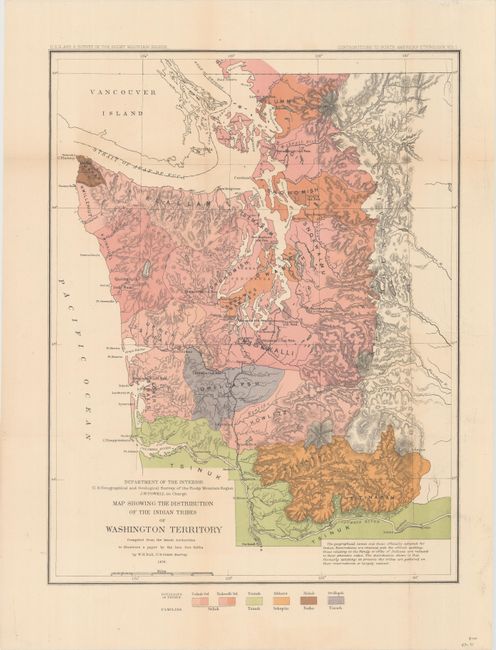
Compiled by W.H. Dall, U.S. Coast Survey, from the latest authorities to illustrate a paper by Geo. Gibbs and under the direction of J.W. Powell. The map is a detailed examination of the Indian Tribes west of the Cascades. A legend provides the key to the coloring of the tribes. It identifies the tribes of Tsihali-Sel and Niskwalli-Sel (from the Selish Family), Tsinuk (Tsinuk Family), Klikatat (Sahaptin Family), Makah (Nutka Family), and the Owillapsh Tribe of the Tinneh Family. A note states that the official spelling of the tribal names are reduced to their phonetic value. Locates the Niskwalli, Swiwamish, Muckleshoot, Chelalis, and Shoalwater Indian Reservations, to name a few. The only railroad exists between Kalama and Tacoma.
References:
Condition: B+
Issued folding and now flattened and backed with tissue to repair a few tiny fold separations.