Subject: Washington
Period: 1861 (dated)
Publication: Sen. Ex. Doc. No. 1, 37th Cong. 2nd Sess.
Color: Black & White
Size:
28.2 x 21.9 inches
71.6 x 55.6 cm
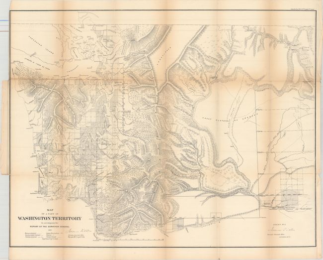
This is an early and uncommon map of Washington Territory that extends south to Oregon and east to just beyond Walla Walla. It is a detailed map that provides information on the extent and status of surveying in the territory and shows watershed, mountains in hachure, Indian and military reservations, and forts. This edition pre-dates the display of gold regions that first appear on the 1862 issue. Signed in the plate by James Tilton, Surveyor General at Olympia on Sept. 9th, 1861.
Washington Territory was created in 1853 and despite Indian hostilities (Yakima Wars 1855-56), some surveying progress was achieved west of the Cascades. Construction of several Army forts (shown on the map) and military roads continued periodically, supporting further survey efforts. The outbreak of the Spokane War (1858-59) did hamper surveyors and the map reflects a portion of the territory as "unexplored."
References: Wheat (TMW) #1037.
Condition: B
Issued folding with light toning along the folds, several short splits at fold intersections, and a 3" binding tear at left that has been closed on verso with archival tape.