Subject: New York City, New York
Period: 1960 (dated)
Publication:
Color: Printed Color
Size:
24.6 x 18.8 inches
62.5 x 47.8 cm
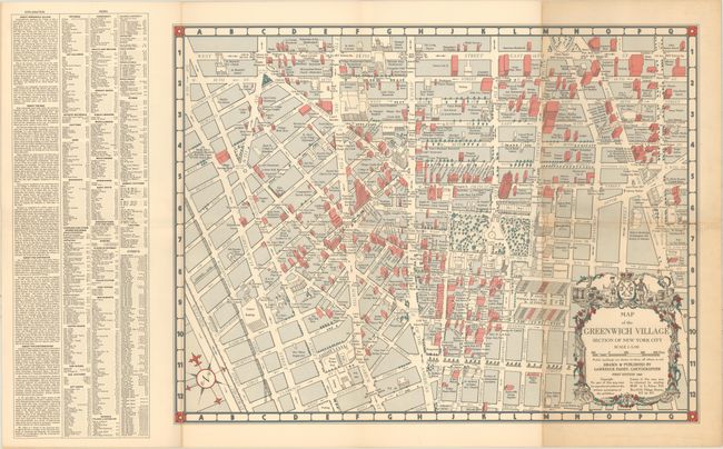
This map of the Greenwich Village neighborhood of New York City is roughly centered on Washington Square. It is bounded by 14th Street to the north, 3rd Street to the east, Prince Street to the south, and the Hudson River to the west. The map was issued with the tourist in mind, and locates and names numerous buildings in red (private) and white (public). Includes a key and panel of text at left that states "the Village has long been a focus of youthful rebellion and Bohemian life" and that for "the tourist, the visitor from the other boroughs, the kid home from college, the Village is a playground, a place where he can 'let his hair down' ". Printed on heavy paper with a decorative title cartouche that is based upon the cartouche in Ratzer’s Plan of the City of New York in North America published in 1776. Price is noted as $3.00.
References:
Condition: B+
On a heavy sheet with light toning along the right panel and one tiny tear that has been closed on verso with archival tape.