Catalog Archive
Auction 161, Lot 334

NO RESERVE

"Scarborough's New Railroad, Post Office, Township, and County Map of New York with Distances Between Stations...", Scarborough Company, The
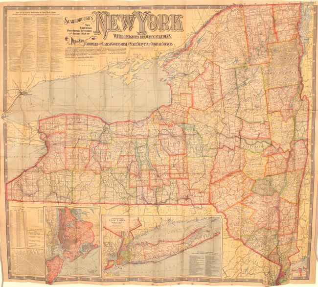
Subject: New York

Period: 1903 (dated)

Publication:

Color: Printed Color

Size:
45.2 x 41 inches
114.8 x 104.1 cm
Download High Resolution Image
(or just click on image to launch the Zoom viewer)

This large scale map of the state is delineated by county and township and features a dense network of roads and railroads throughout. Includes insets "Map of New York City" and "Southeastern Part of New York" at bottom. Panels of text along the left border include a complete list of railroads in the state, a table of distances between cities, and population statistics. Decorated by a keyboard-style border and fancy titling. Self-folds into brown cloth boards (5.0 x 9.7").

References:

Condition: B+

Issued folding on heavy linen with light toning and several tiny splits at fold intersections. Front board is missing.

Estimate: $80 - $100

Sold for: $9

Closed on 2/8/2017

Archived