Catalog Archive
Auction 161, Lot 303

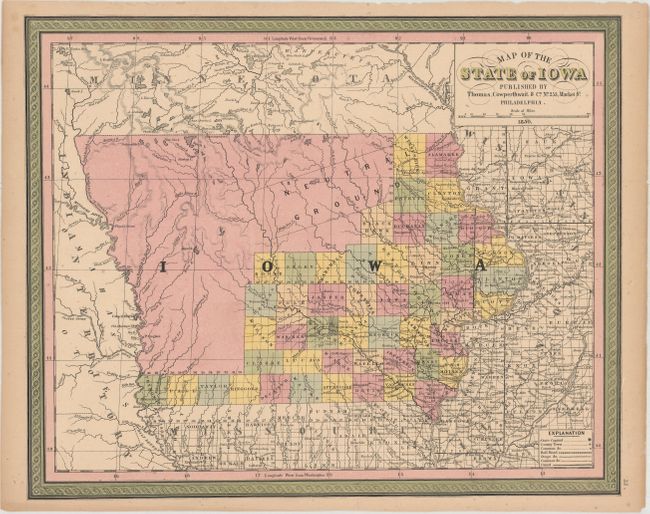
"Map of the State of Iowa", Thomas, Cowperthwait & Co.
Subject: Iowa

Period: 1850 (dated)

Publication:

Color: Hand Color

Size:
15.8 x 12.9 inches
40.1 x 32.8 cm
Download High Resolution Image
(or just click on image to launch the Zoom viewer)

A fine map of the state showing the extent of settlement. County development is confined to the eastern and southern portion of the state where a road network is beginning to take shape with many stage roads depicted. A large area in the mostly unsettled area of the north is named "Neutral Ground", which was a 40 mile by 200 mile stretch of land intended to keep the Sauk and Fox tribes from warring with the Sioux and Dakota tribes. A decorative border surrounds the map.

References:

Condition: B+

Full original color with light toning and some tiny chips along the edges of the sheet.

Estimate: $120 - $150

Sold for: $90

Closed on 2/8/2017

Archived