Subject: Southern United States
Period: 1799 (dated)
Publication: A New and Complete Universal Geography
Color: Black & White
Size:
15.2 x 7.9 inches
38.6 x 20.1 cm
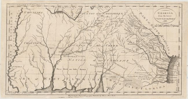
This is a scarce map covering from the Atlantic seaboard to the Mississippi River, present-day Georgia, Alabama and Mississippi. There is good topographical information, particularly for the eastern section near the coast. Early counties in Georgia are named and their boundaries given. The interior is labeled Country of the Creek Nation of Indians with several other tribes located and the notation "These parts are little known." Several trading paths to the interior are shown. This is a re-engraving of based upon earlier maps by Tanner in 1796 and Carey in 1795.
References: Wheat & Brun #619.
Condition: B+
A sharp impression, issued folding and now flattened and backed in thin Japanese tissue. There are expert and nearly invisible repairs to separations along the left fold and to three tears ranging from 1" to 2.5" adjacent to the left fold.