Subject: Colonial Southern United States
Period: 1772 (dated)
Publication: Gentleman's Magazine
Color: Hand Color
Size:
13.6 x 7.6 inches
34.5 x 19.3 cm
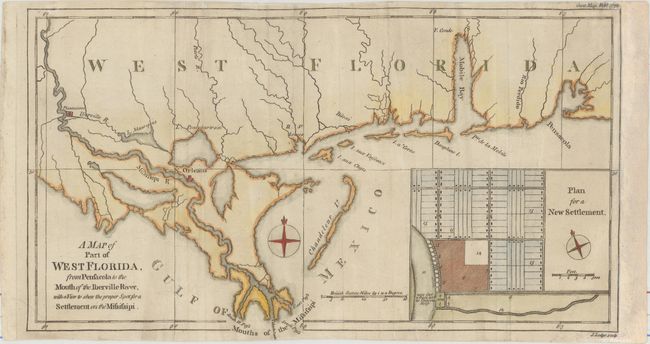
This copper engraved map features Mobile Bay and Fort Conde, New Orleans and locates Plantations along the Mississippi well north of New Orleans. The large inset "Plan for a New Settlement" shows the proposed street layout and wharf and docks along the river. It is reported that this map was published in response to reports that the British government was considering the settlement of a colony on the banks of the Mississippi; the point suggested was near today's Baton Rouge. However, further up the Mississippi River the area labeled 'Plantations' is identical to the plan.
References: Jolly #GENT-217; Sellers & Van Ee #1650.
Condition: B+
Issued folding with some extraneous creasing that has been pressed flat. A binding trim at right has been replaced with old paper to accommodate framing. The top and bottom margins are somewhat narrow, but still ample for framing.