Subject: Colonial Southern United States
Period: 1729 (circa)
Publication: Atlas Minor
Color: Hand Color
Size:
10.8 x 7.9 inches
27.4 x 20.1 cm
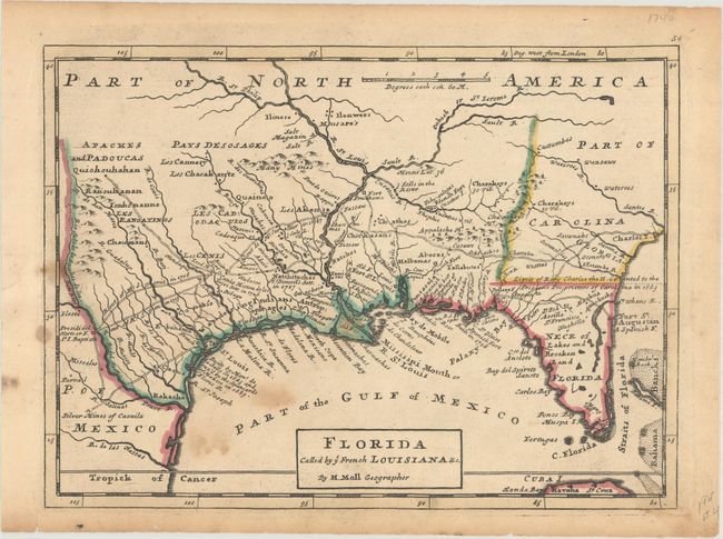
This map is based on Moll's larger map of 1720 and portrays the Gulf Coast and Florida with detail of Indian villages, missions, mines and forts. It is one of the earliest printed maps to describe the roads and trading paths in the region. It is also filled with interesting notations including notes on La Salle's landing in Texas in 1685, the Cenis Missions and early Texas settlements in 1716-17, and the limits of King Charles II's Grant to the Lord Proprietors (Carolina) in 1663.
References: Cumming (SE) #201, Phillips (A) #574.
Condition: B
A nice impression on paper with a simple fleur-de-lis watermark. There are several stains in the image and light toning along the bottom of the sheet. A short tear in the bottom blank margin has been closed on verso with archival tape.