Subject: Mid-Atlantic United States
Period: 1820 (dated)
Publication: American Atlas
Color: Hand Color
Size:
29.1 x 19.8 inches
73.9 x 50.3 cm
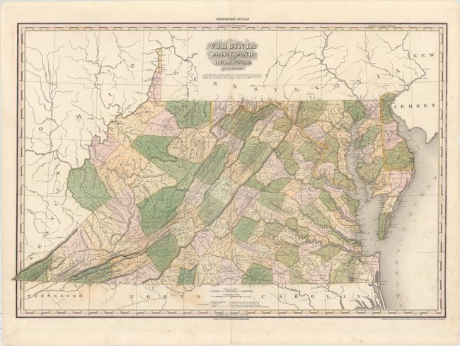
This large, attractive map was published in Tanner's first edition American Atlas, which is considered one of the finest American atlases ever published. Delineated by county, the map is filled with detail of cities and towns, wagon roads, drainage and topography. The map also shows distances from various locations to the state capitals of Richmond, Annapolis and Dover. County development is current to 1820 with the addition of Morgan in the northern part of Virginia. Two distance scales show American and Geographical Miles.
Henry Schenck Tanner was one of the most productive and successful cartographic publishers of the early nineteenth century, a period known as the golden age of American cartography. The large, beautifully engraved maps from this atlas were considered among the "most splendid works of the kind ever executed in this country," as reported in the United States Gazette (Philadelphia) in 1823.
References: Phillips (Atlases) #4462-9.
Condition: B+
Original color with a number of centerfold separations that have been professionally repaired on verso. There are minor stains in the bottom portion of the image.