Subject: North America, Texas
Period: 1839-43 (circa)
Publication:
Color: Hand Color
The Republic of Texas was a sovereign state in North America from 1836 to 1845. It was formed as a break-away republic from Mexico by the Texas Revolution. The nation claimed a large region that included all of the present state of Texas together with part of the former Mexican region of New Mexico (parts of present-day New Mexico, Oklahoma, Kansas, Colorado, and Wyoming). The eastern boundary with the United States was defined by the Adams-Onís Treaty between the United States and Spain, in 1819. Its southern and western-most boundary with Mexico was under dispute throughout the existence of the republic, with Texas claiming that the boundary was the Rio Grande, and Mexico claiming the Nueces River as the boundary.
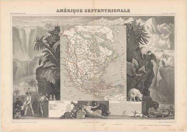
A. Amerique Septentrionale, by Victor Levasseur, from Atlas Universel Illustre, circa 1843 (17.2 x 11.3"). This richly engraved map of North America shows the United States' claims into present-day Canada reflecting the Oregon boundary dispute. The Republic of Texas is shown in its smaller configuration, and Mexico's northern border is drawn according to the Treaty of 1819 (here misprinted as 1810). Russia is in control of Alaska. The map is surrounded by beautifully engraved scenes of North and Central America including wildlife, a ship stranded in the polar sea, and a Mayan temple. Condition: Original outline color with minor soiling confined to the blank margins. (A)
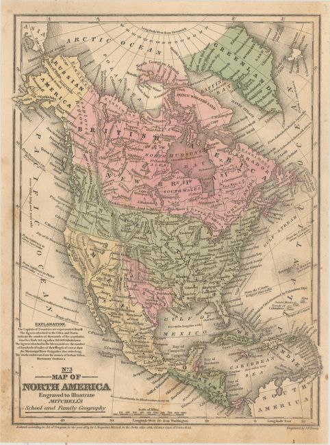
B. No. 3 Map of North America Engraved to Illustrate Mitchell's School and Family Geography, by Samuel Augustus Mitchell, dated 1839 (8.0 x 10.4"). Nice map that shows a large Independent Republic of Texas extending to the 42nd parallel with a long stovepipe panhandle that incorporates Santa Fe. Austin is shown as the capital, and San Felipe and Bexar are located. Above Texas is the Great American Desert. The United States extends to the Pacific with Ft. George or Astoria, Ft. Colville, and Ft. Wallah-Wallah named. The Northwest extends well into Canada geographically showing the "Fifty-four Forty or Fight" dispute with Britain. Mexico controls California and the Southwest. Alaska is Russian America with the Aleutian Peninsula labeled Alaska. Cook's Inlet is well shown. Canada is depicted as British America and New Britain. Numerous Indian tribes, major towns, good detail of major rivers, and a vague idea of the Rocky Mountains are shown. This early edition has a blank verso. Condition: Original color with light soiling and minor foxing. (B+)
References:
Condition:
See description above.