Subject: Colonial North America
Period: 1740 (circa)
Publication:
Color: Black & White
Size:
17 x 13.1 inches
43.2 x 33.3 cm
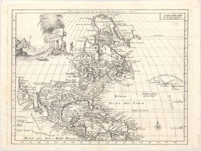
This is Albrizzi's version of Delisle's landmark map of North America. It is nearly identical to the Delisle map with California returned to its peninsular position rather than as an island. C. Mendocin is the farthest northern point on California, and the north portion of the continent is left blank. The tracks of Cortez, Drake and Olivier are noted in the Pacific, and the Great Lakes are well-defined, based on Coronelli. The English settlements are confined east of the Alleghenies and the Spanish forts are clustered around Santa Fe, here shown as a large fortification. The Mississippi River Valley is delineated with French forts located, including F. St. Luigi (St. Louis).
References:
Condition: A
A dark impression on watermarked paper with a short edge tear at bottom that has been closed on verso with archival tissue and very minor soiling. There are some small chips and short edge tears in the blank margins that have been backed in tissue.