Subject: References
Period: 1959-2002 (published)
Publication:
Color: Printed Color
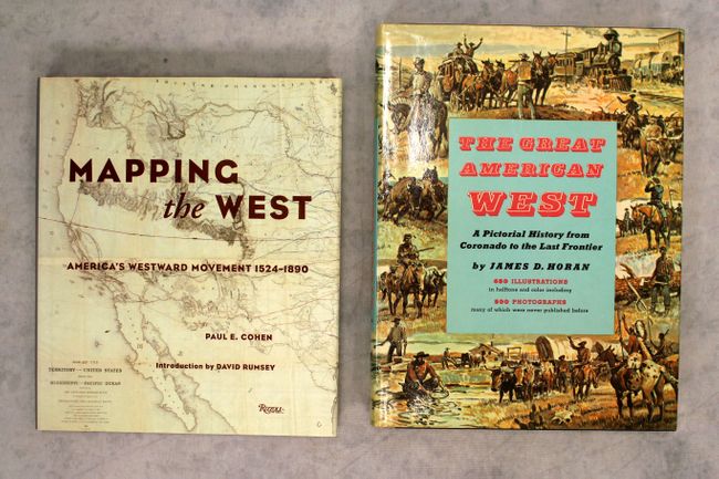
A. Mapping the West - America's Westward Movement 1524-1890, by Paul E. Cohen, published 2002, (9.4 x 10.9"). This elegantly laid out reference contains 65 full-color reproductions of maps of the American West, starting with Cortes' map of the Gulf of Mexico and plan of Mexico City (1524) and ending with a map of the United States by the General Land Office (1890). It includes essays from 19 experts, divided into the following categories: Discovering the West; European Mapping of the West; Staking Claims; The Maps of the Lewis and Clark Expedition; Landmark Maps of the West; Military and Commercial Mapmaking; Routes Westward; The Mexican War and Its Aftermath; Mapping the Territories; Railroads, Rivers, and States; and The End of the Frontier. This is the first time several of these maps have been shown. Noted collector David Rumsey wrote the introduction. Hardbound with embossed title on front cover and gilt titles on spine. Illustrated dust jacket. 208 pp.
B. The Great American West - A Pictorial History from Coronado to the Last Frontier, by James D. Horan, published 1959, (9.3 x 12.3"). This informative and entertaining reference provides a whirlwind overview of the history of the West. It is copiously illustrated with 650 illustrations and 500 photographs, 38 of them color plates. Hardbound in black and tan cloth and an illustrated dust jacket. 288 pp.
References:
Condition: A
Contents tight and covers very good with just a little shelf wear. There is light wear and sunning to the dust jacket of the latter volume.