Subject: Eastern Asia
Period: 1898-1902 (dated)
Publication:
Color: Black & White
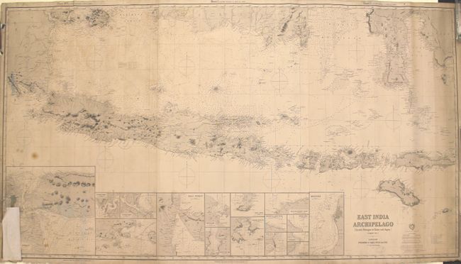
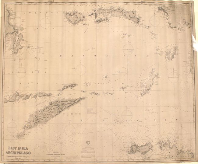
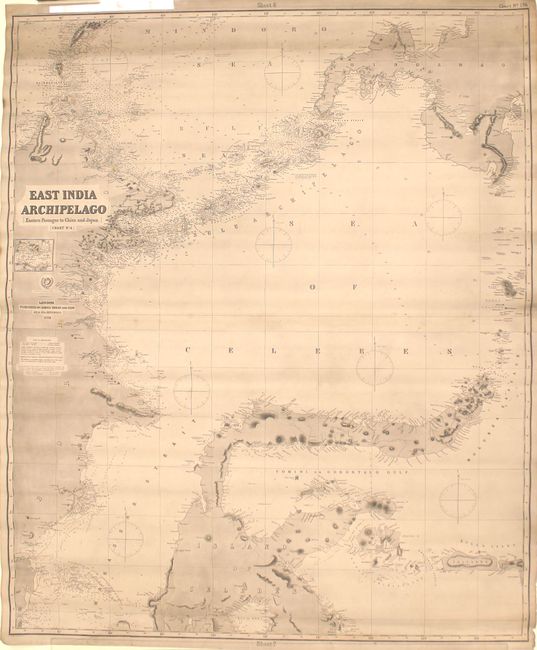
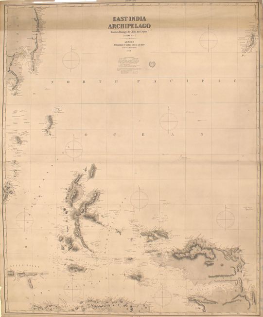
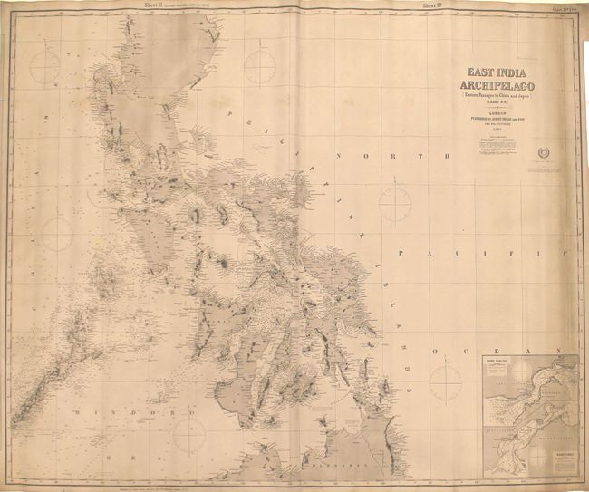
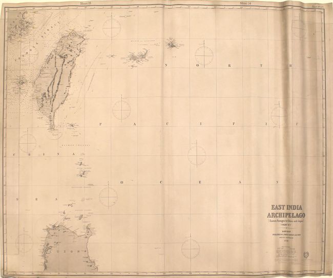
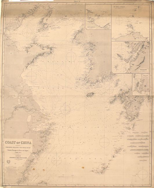
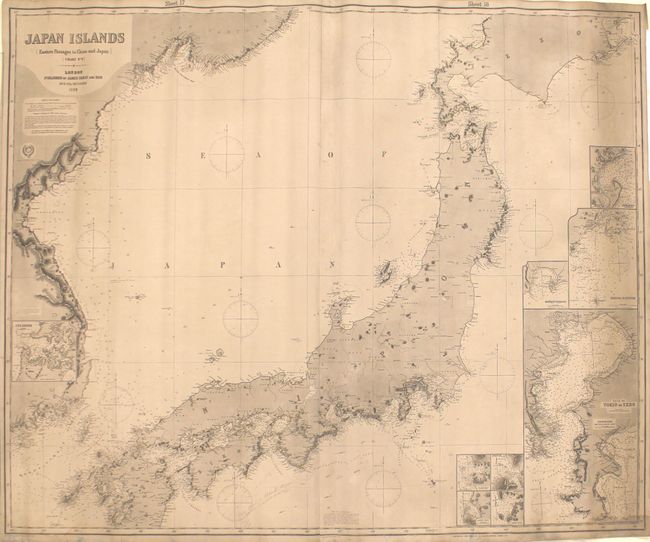
This impressive group of eight blueback charts covers eastern Asia from the Sunda Strait through parts of Indonesia, Philippines, coastal China and Japan. Of particular interest is chart #6 featuring excellent detail of the Philippines, and chart #9 depicting Japan with a large inset of Tokyo. Each of the charts is filled with a multitude of navigational information including soundings, reefs, rocks, and shoals, as well as navigational routes and currents. There is also good information along the coasts of towns, capes, points, rivers, and mountain peaks. Lighthouses are marked with yellow and red, as is typical on Imray charts. A remarkable set of charts of this important region.
A. East India Archipelago [Eastern Passages to China and Japan] [Chart No. 1], dated 1902 (72.8 x 40.1"). Condition: There is a 10" edge tear at right, and 3" and 2" edge tears at left. An old paper repair is visible in the bottom left corner of the map. (C+)
B. ... [Chart No. 2], dated 1898 (48.5 x 39.9"). Condition: Very good. (B+)
C. ... [Chart No. 4], dated 1898 (39.8 x 48.6"). Condition: There is a 2.5" edge tear at bottom, otherwise very good. (B)
D. ... [Chart No. 5], dated 1898 (40.1 x 48.6"). Condition: A few minor edge tears mostly confined to the blank margins. (B+)
E. ... [Chart No. 6], dated 1898 (48.4 x 39.9"). Condition: Very good. (B+)
F. ... [Chart No. 7], dated 1898 (48.8 x 39.9"). Condition: There is a vertical crease at right spanning the length of the map. (B+)
G. Coast of China Between Formosa Island & Pe-Chi-Li Gulf [Eastern Passages to China and Japan] [Chart No. 8], dated 1900 (40.1 x 49.5"). Condition: Light toning at top with a few minor edge tears in the blank margins. (B+)
H. Japan Islands [Eastern Passages to China and Japan] [Chart No. 9], dated 1898 (48.6 x 39.9"). Condition: Light toning at right with minor pencil notations in the image. (B+)
References:
Condition:
The maps are overall good to mostly very good for their intended purpose with light soiling, staining, and minor surface abrasions. The maps have been stored rolled with a few of the charts somewhat cockled. See description above for additional details.