Subject: Holy Land
Period: 1649 (dated)
Publication: A Pisgah-Sight of Palestine
Color: Hand Color
Size:
13.3 x 10.9 inches
33.8 x 27.7 cm
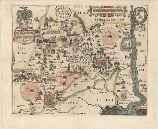
This delightfully illustrated map covers the territory of Benjamin, one of the twelve tribes of Israel. Bounded by the Jordan River in the east and Jerusalem and Bethlehem in the southwest, the map is roughly centered on Jericho. The map is filled with pictorial illustrations and is embellished with a coat of arms and dedication cartouche and the shield of the Tribe of Benjamin. Engraved by Robert Vaughan, whose imprint appears at bottom right.
Thomas Fuller (1608-1661) was a respected English clergyman who wrote several books on the history and geography of the Holy Land. His A Pisgah-Sight of Palestine, published in 1650, was a geographical description of the Holy Land with special reference to biblical history. Fuller financed the book by dividing it into sections and finding sponsors for each one. To acknowledge the patrons, all maps contained decorative cartouches with the sponsor's coat of arms and a dedication to him.
References: Laor #291; Nebenzahl (HL) p.128-131, #14; Shirley (BL Atlases) G.FULL-1a #13.
Condition: A
A nice impression on watermarked paper with two small worm tracks in the blank margins that have been professionally repaired.