Catalog Archive
Auction 160, Lot 488

"Monumethensis Comitatus, quem olim Incoluerunt Silures", Saxton/Hole
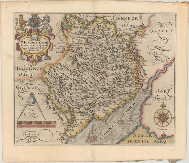
Subject: Wales

Period: 1637 (published)

Publication: Camden's Britannia

Color: Hand Color

Size:
13.5 x 10.9 inches
34.3 x 27.7 cm
Download High Resolution Image
(or just click on image to launch the Zoom viewer)

An early map of the county of Monmothshire engraved by William Hole and based upon the famous survey by Christopher Saxton. The map is fully engraved with cities, rivers, mountains, and forested areas. Embellished with a strapwork cartouche, a sailing ship, a compass rose, and measuring dividers. Published in the 1637 edition of Camden's Britannia, with the addition of a plate number on the map.

References: Shirley (BL Atlases) T.CAMD-1e.

Condition: A

A dark impression on watermarked paper with several minor printer's creases and a couple of minute worm holes only visible when held to light.

Estimate: $120 - $150

Sold for: $60

Closed on 11/16/2016

Archived