Subject: North Atlantic
Period: 1851 (dated)
Publication:
Color: Black & White
Size:
38.4 x 26.5 inches
97.5 x 67.3 cm
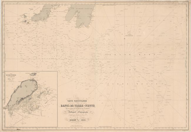
This detailed chart covers the North Atlantic south of the southernmost portion of Newfoundland and Saint Pierre and Miquelon. It includes depth soundings, bottom types, lighthouses, banks, and other navigational information. The Grand Banks of Newfoundland and Virgin Rocks are located. An inset at bottom left focuses on Saint Pierre, depicting the island in excellent topographical detail.
References:
Condition: B+
A nice impression with minor soiling, a few small worm holes that have been closed on verso, an ink stain just above the neatline at bottom left, and some edge tears that have been repaired on verso. There are some small chips in the top right corner that have been replaced with old paper, with a small portion of neatline replaced in facsimile.