Catalog Archive
Auction 160, Lot 439

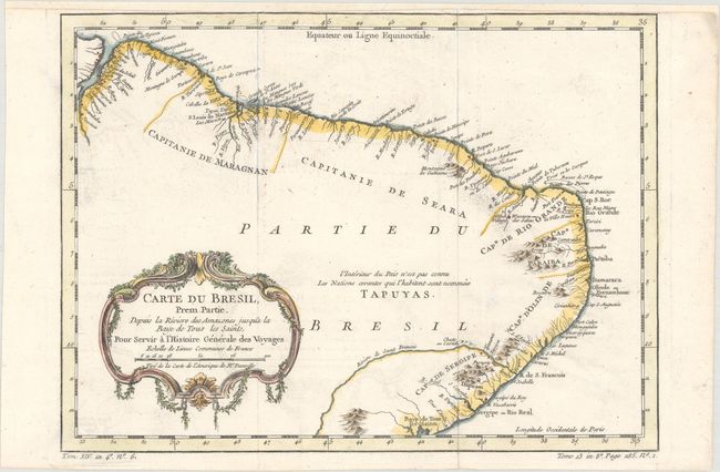
"Carte du Bresil, Prem. Partie. Depuis la Riviere des Amazones Jusqua la Baye de Tous les Saints, pour Servir a l'Histoire des Voyages", Bellin, Jacques Nicolas
Subject: Brazil

Period: 1764 (circa)

Publication: Prevost's Histoire Generale des Voyages

Color: Hand Color

Size:
12.8 x 9.4 inches
32.5 x 23.9 cm
Download High Resolution Image
(or just click on image to launch the Zoom viewer)

This map extends from the mouth of the Amazon River to the Bay of All Saints in Salvador, showing coastal detail with the interior region noted as being unknown and the domain of the Tapuyas Indian nation. Adorned with a decorative title cartouche featuring draped vines.

References:

Condition: B+

Issued folding, now flattened, on watermarked paper with faint offsetting and light soiling. There is one tiny repaired hole in an unengraved area of the map and the map has been remargined at top with old paper.

Estimate: $120 - $150

Unsold

Closed on 11/16/2016

Archived