Subject: Venezuela
Period: 1680 (circa)
Publication:
Color: Hand Color
Size:
23.1 x 20.3 inches
58.7 x 51.6 cm
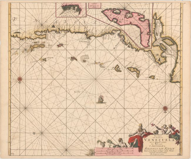
A superb sea chart covering the Venezuelan coastline and the Netherlands Antilles of Curacao, Bonaire and Aruba. Insets provide detailed information on Curacao and the Dutch fortress and salt works on Isla La Tortuga. The chart is oriented with north at the bottom by two compass roses and includes a large title cartouche featuring Neptune, the lord of the sea, with his entourage. The Van Keulen firm dominated Dutch sea chart publication for much of its existence between 1680 and 1885.
References:
Condition: B+
Fine impression and original color, printed on sturdy paper with good margins. There are a couple insignificant spots including a tiny hole (paper flaw) near the compass rose at left and a short crack at bottom right that has been closed on verso with archival material, still in overall very good condition.