Subject: World
Period: 1906 (dated)
Publication:
Color: Printed Color
Size:
26.8 x 35.1 inches
68.1 x 89.2 cm
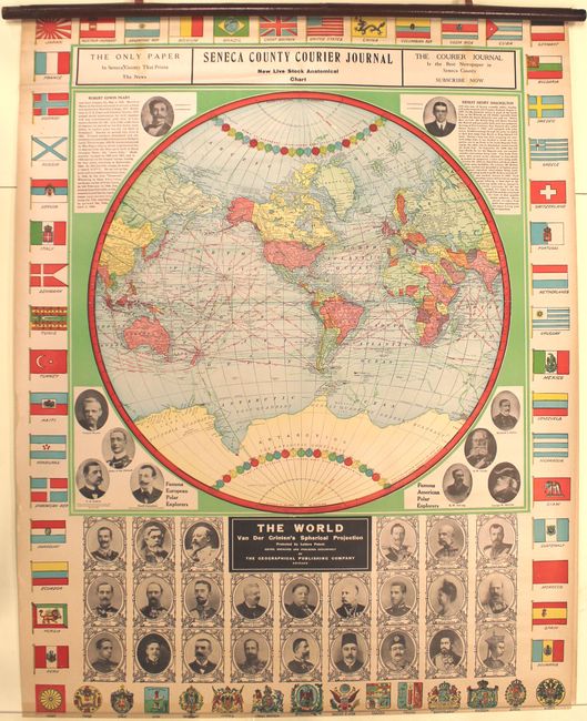
This attractive political map of the world shows ocean currents, shipping lanes, isothermal lines, and explorer routes on a spherical projection. It is surrounded by portraits of famous polar explorers including Robert Edwin Peary and Ernest Henry Shackelton. Below the map is a collection of portraits of world leaders including President Taft at center, and the entire composition is lined by coats of arms and flags. The map is dated 1906, but is circa 1910 given that Taft is shown as President.
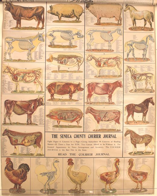
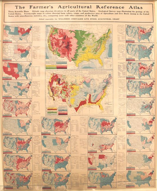
While the Geographical Publishing Company produced the map, it was distributed by the Seneca County Courier Journal (NY) as a promotional piece, and includes two additional sheets focused on agriculture. The first contains anatomical charts of livestock, while the second shows numerous thematic maps of the United States related to agricultural output. The sheets have related text on verso. Wooden rollers are present and intact.
References:
Condition: A
The three map sheets are in remarkable condition with just a hint of toning along sheet edges. Wooden roller is present and intact.