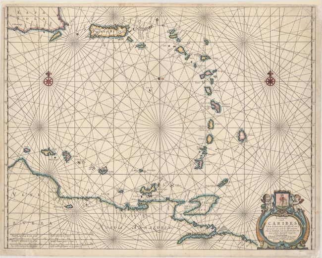
"Pascaerte vande Caribes S. Iuan de Porte Rico, de Oosthoeck van I. Spangnola als mede de Vaste Cust van Nueva Andalusia...", Jacobsz, Jacob
Subject: Lesser Antilles
Period: 1667 (circa)
Publication:
Color: Hand Color
Size:
21.6 x 16.9 inches
54.9 x 42.9 cm
Fine, rare sea chart of the Lesser Antilles from the southeastern shore of Hispaniola and Puerto Rico to the the Dutch ABC islands off the coast of Venezuela. The chart is embellished with two compass roses, rhumb lines, and a decorative cartouche featuring a coat of arms and putti. This map was published by Jacob Theunis Lootsman, also known as Jacob Jacobsz, son of Anthony Jacobsz. When Jacob and his brother, Caspar, took over the family business, they began using the surname "Lootsman" to distinguish themselves from others with the "Jacobsz" name.
References: Shirley (BL Atlases) M.LTS-1a.
Condition: B+
A crisp impression with one small stain along the centerfold and minor soiling. There are professional repairs to a tear in the top right corner of image and to a small chip at bottom right, outside of image. Top margin has been extended to accommodate framing.