Subject: Hispaniola
Period: 1730 (circa)
Publication:
Color: Hand Color
Size:
24 x 18.4 inches
61 x 46.7 cm
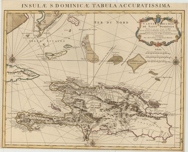
This is an important map of Hispaniola and the Turks & Caicos Islands. When initially published in 1722 by Delisle it was one of the first to depict the island's true contours following Frezier's important map of the island. The chart provides excellent detail of the mountains, roads, towns, ports, plantations, sugar works and navigational hazards. This edition has been updated to include rhumb lines, two additional compass roses, and navigational routes to various islands, including Turks, Caicos, and Crooked Island. Decorated with a large title cartouche. Latin title above, "Insulae S. Dominicae Tabula Accuratissima."
References:
Condition: A
A dark, crisp impression on heavy paper with a "C & Honig" watermark. Original outline color with later coloring in the cartouche and compass roses. There is minor soiling at bottom right and a narrow bottom margin.