Subject: World
Period: 1830 (circa)
Publication: Modern Atlas
Color: Hand Color
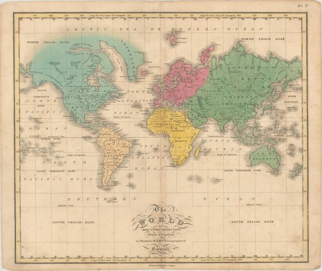
A. The World on Mercator's Projection Drawn & Engraved to Illustrate Hart's Geographical Exercises, J.C. Hart (14.9 x 12.7"). This attractive, rudimentary map of the world is drawn on Mercator's projection and excludes both polar regions. The northern portion of Canada is not fully delineated, but the discoveries of Parry, Franklin and MacKenzie are noted. Shows basic detail of large cities, rivers, and political boundaries. Condition: Light scattered foxing with light toning along the centerfold. (B+)
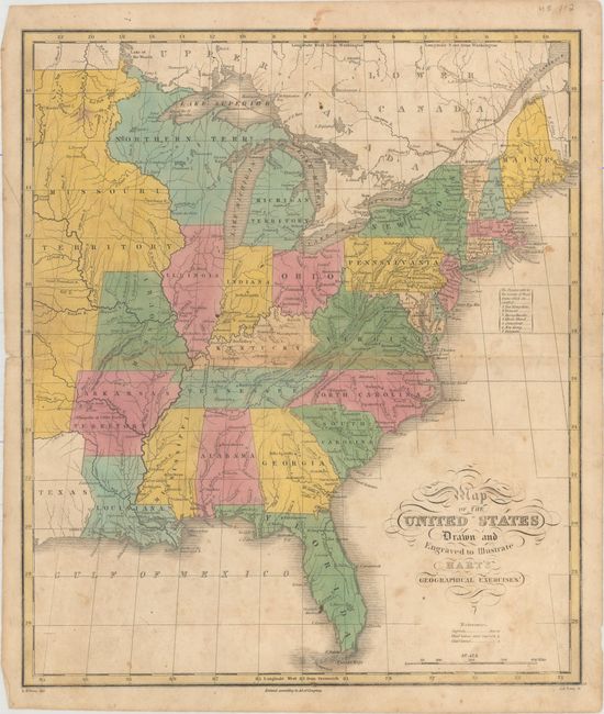
B. Map of the United States Drawn and Engraved to Illustrate Hart's Geographical Exercises, J.C. Hart (12.8 x 15.0"). Attractive map of the eastern United States that extends past the Mississippi River to include a small portion of Texas and Missouri Territory. Shows Arkansas Territory in its smaller configuration, and a Northern Territory that encompasses present-day Wisconsin and eastern Minnesota. Shows good detail of the river systems and topography, and names numerous cities and towns. Condition: Light scattered foxing with a 3" centerfold separation spanning Virginia. (B)
References: Phillips (A) #757-1 & #757-3.
Condition:
See description above.