Subject: Yellowstone, Wyoming
Period: 1880-1909 (circa)
Publication:
Color:
An attractive set of Yellowstone National Park maps produced around the turn of the 19th century including:
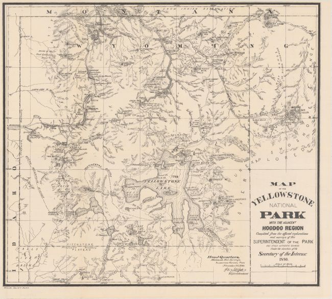
A. Map of the Yellowstone National Park with the Adjacent Hoodoo Region..., by U.S. Department of Interior, from House. Ex. Doc. No. 1. Part. 5, black & white, dated 1880 (17.5 x 15.8"). This map is roughly centered on Yellowstone Lake and shows the "Hoodoo" or Goblin Mountain to the east of the park. This area was given its name for the giant rocks that jut up to 60 feet in the air and have a ghostly appearance. Shows the "Route of Exploration" from the Indian Lodges just outside of the eastern park boundary to the Hot Springs. While dated 1880, this map was likely a later printing (circa 1900).
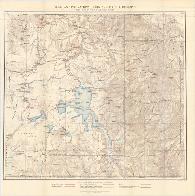
B. Yellowstone National Park and Forest Reserve from Maps by the U.S. Geological Survey, by U.S. Geological Survey, printed color, circa 1902 (19.4 x 17.9"). This finely detailed topographical map shows all of Yellowstone Park plus the region to the east up to Bighorn County, in today's Park County. It has good topographical detail with contour intervals at 100 feet at a scale of 1 inch = 4 miles. The Upper, Shoshone, Gibbon, and Heart Lake Geyser Basins are named, along with the Mud Geysers, Mammoth Hot Springs and Old Faithful Hotel.
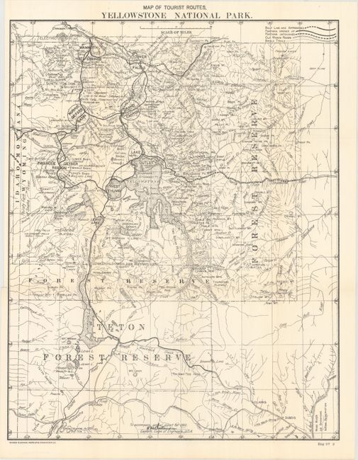
C. Map of Tourist Routes, Yellowstone National Park, by Andrew B. Graham, black & white, circa 1902 (16.4 x 20.8"). This is the map a tourist would have seen at the turn of the 20th century. It show the entire park with all roads, geyser basins and other information important to the visitor. Legend further identifies old wagon roads, bridle trails, and more. From Capt. H.M. Chittenden's report on development of the park in 1902.
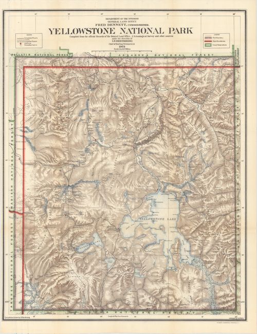
D. Yellowstone National Park Compiled from the Official Records of the General Land Office, U.S. Geological Survey and Other Sources..., by General Land Office, printed color, dated 1909 (20.2 x 25.6"). Attractive map that is filled with many details, showing all rivers and streams, waterfalls, lakes, roads, and trails. The legend further delineates the Snowshoe Cabins, Stations, and differentiates between trails and roads. It locates all of the geyser basins plus it names scores of individual geysers. The recently constructed Old Faithful Lodge is on the map simply as "Hotel." The effect of stone lithography is evident in the depiction of contour with stipple-style shading. A most handsome map of the park completed during Fred Dennett's term as Commissioner to the General Land Office.
References:
Condition: A
Overall clean and bright examples. Issued folding.