Subject: World
Period: 1780 (circa)
Publication:
Color: Hand Color
Size:
17.3 x 13.5 inches
43.9 x 34.3 cm
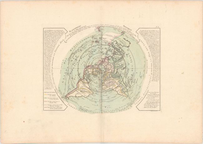
This scarce and unusual thematic map is presented on a North Polar projection and depicts the tracks of several important explorers including Tasman, Halley and Magellan. The color-coding identifies which landmasses drain into the various bodies of water around the world. Inland detail is confined to rivers and major mountain ranges depicted with strong hachures. In North America there is a large Sea of the West and a nearly complete Northwest Passage. Australia is still shown with a conjectural coastline, making it considerably too wide. The continent connects to both New Guinea and Terre du St. Esprit (the Land of the Holy Ghost), discovered by Queiroz. Engraved by Desbruslins.
References: McGuirk #60; Phillips (Maps) p. 1091; Potter pp.178-9 (illus).
Condition: A
On a sheet of watermarked paper with wide original margins. There is minor soiling confined to the blank margins.