Subject: Florida
Period: 1835-70 (circa)
Publication:
Color: Hand Color
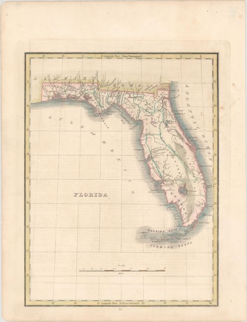
A. Florida, by Thomas Gamaliel Bradford, circa 1835 (7.8 x 10.2"). A beautiful example of this map which details Florida several years prior to attaining statehood. It is a clean and precise engraved style with delicate original hand coloring used to outline the counties. The exact number of counties named is unclear. Columbia county was created from a portion of Alachua, whose name still stretches across the new county. The large non-county area at the middle of the peninsula is Indian lands which in 1834 provided most of the land for the new Hillsborough County. Included with the map is a page of descriptive text. Condition: Faint scattered foxing with light offsetting from an opposing page of text.
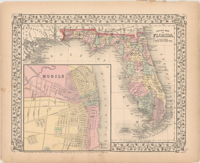
B. County Map of Florida, by Samuel Augustus Mitchell Jr., dated 1870 (13.6 x 10.8"). Map features Mitchell's lovely grapevine border and a large and detailed inset plan of Mobile. Good detail throughout shows Florida with 36 counties. The railroads traverse the northern portion, extending only as far south as the Crystal River region, here named Atsena Otie. The Everglades and Big Cypress Swamp cover the entire southern portion. Miami is named and the map extends to the Dry Tortugas. Condition: There are a few spots of foxing and minor toning along sheet edges.
References:
Condition: B+
See description above.