Subject: Northwestern United States
Period: 1876-82 (circa)
Publication:
Color: Hand Color
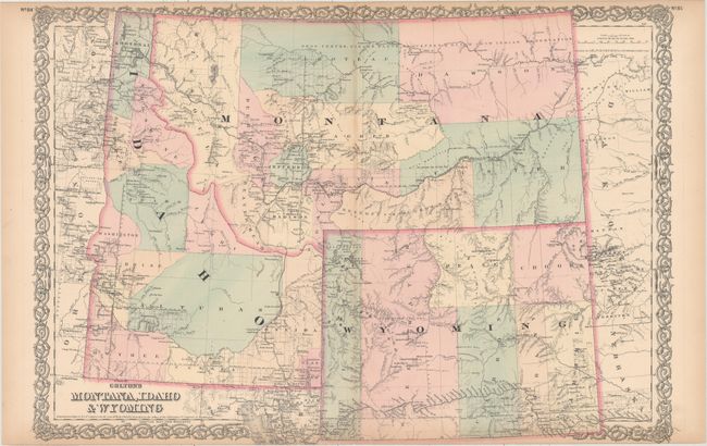
A. Colton's Montana, Idaho & Wyoming, by G.W. & C.B. Colton & Co., dated 1876 (25.4 x 17.3"). This is a handsome regional map with nice topographical detail. The map illustrates the sections than have been surveyed in each territory and locates settlements, Indian reservations, railroads, mining communities, and forts. Virginia City is the capital of Montana.
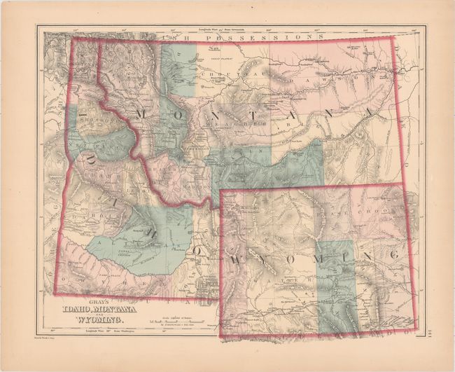
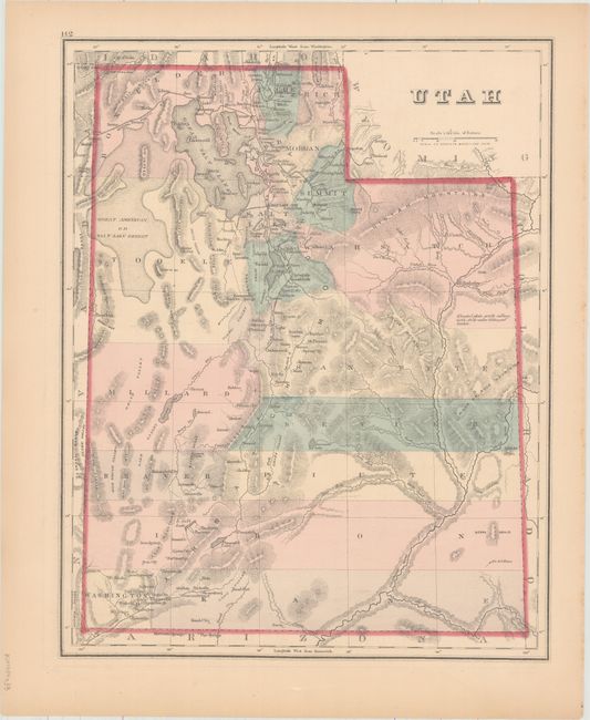
B. Gray's Idaho, Montana and Wyoming [on verso] Utah, by Frank A. Gray, circa 1876 (14.8 x 12.2"). Locates the "Proposed National Park" (Yellowstone) which was established in 1872, but the map had not been updated to reflect the new name. Shows the Union Pacific line going through southern Wyoming and the proposed Northern Pacific line through Montana. Filled with settlements, forts, mining communities and Indian reservations. The verso contains a map of Utah Territory.
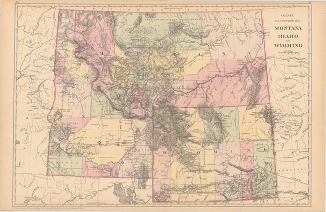
C. County and Township Map Montana Idaho and Wyoming, by Samuel Augustus Mitchell, dated 1882 (21.4 x 14.6"). A later version of the first map by Mitchell that has been updated to show much finer topographical detail with elevation depicted via dense hachuring. The extent of surveying and county configurations have also been updated.
References:
Condition: B+
Overall pleasant light toning. The large Colton map has slightly more pronounced toning along the centerfold and top margin and a tiny separation at bottom.