Subject: United States, Kanawha, Civil War
Period: 1864-68 (circa)
Publication:
Color: Hand Color
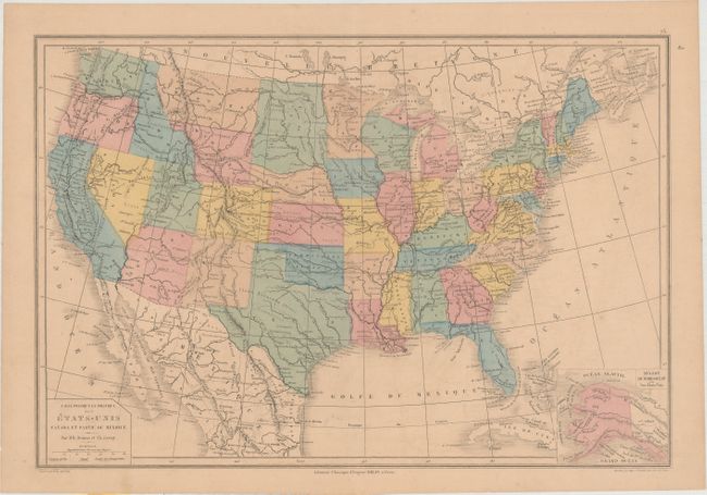
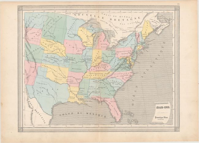
A nice pair of French maps depicting the short-lived state of Kanawha. After Virginia joined the Confederacy in 1861, the 39 counties in the northwestern part of the state voted to secede and named the new state Kanawha after the Kanawha River that went through much of this region. The name was short-lived, however, as members of the state convention determined that there would be too much confusion with its own Kanawha County. After considering several possible names including Allegheny, Augusta, Columbia, New Virginia, and Vandalia, the convention members decided upon West Virginia.
A. Carte Physique et Politique des Etats-Unis Canada et Partie du Mexique, by Drioux & Leroy, circa 1868 (16.9 x 11.5"). In addition to the depiction of "Virginia Oc. ou Kanawha", the map shows preliminary borders for Montana and Wyoming and an unusual northern border of Nebraska. Includes an inset of Alaska at bottom. Condition: Uniform light toning and faint offsetting. (B+)
B. Etats-Unis, by Poussielgue Freres, circa 1864 (13.6 x 10.6"). This map of the eastern United States extends to the Rocky Mountains, with Kanawha near the center of the map image. The engraved political borders appear to wander a bit, resulting in somewhat oddly shaped states/territories in the west. Condition: Light toning along sheet edges. (A)
References:
Condition:
See description above.