Subject: United States
Period: 1860 (dated)
Publication:
Color: Hand Color
Size:
21.6 x 13.3 inches
54.9 x 33.8 cm
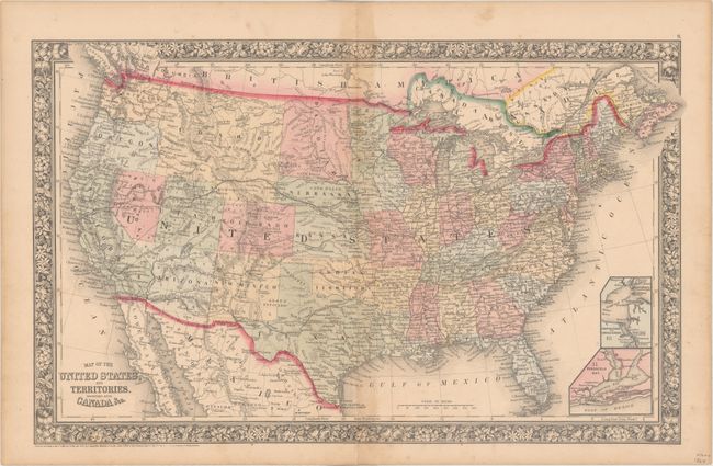
This attractive map features early boundaries for the territories of Dakotah, Idaho, Utah and Arizona. There is no sign of Wyoming or Montana as they are still incorporated into the huge rectangular Idaho Territory. Arizona still includes the southern tip of Nevada. Extensive railroad network throughout the east, with the proposed Pacific Railroads, mail routes, emigrant roads and the Pony Express route are shown in the west. Includes insets of Hampton Roads and Norfolk Harbor, and Pensacola Bay. Surrounded by a floral border. Imprint dates the map to 1860 but it was published circa 1863.
References:
Condition: B+
Light toning along the centerfold, minor staining, and a short centerfold separation that just enters the decorative border at bottom.