Subject: Colonial Eastern North America & West Indies
Period: 1687 (circa)
Publication: De Nieuwe Groote Lichtende Zee-Fakkel
Color: Hand Color
Size:
22.4 x 19.9 inches
56.9 x 50.5 cm
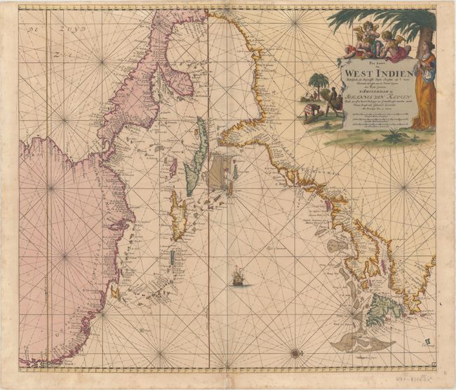
This superb chart depicts the coastline of the western Atlantic Ocean from the mouth of the Amazon River in Brazil to Labrador, Canada. Detail is confined to the coastlines, which are filled with place names, including Charleston, Manhattans Eyl., Plymouth, Boston, Salem, and Quebec. The St. Lawrence River is labeled Le Grand Rivier de Canada. The Caribbean islands are well defined, and numerous fishing banks, rocks, shoals and other navigational hazards are shown. A single compass rose orients north to the right. The map is adorned with a single sailing ship and a decorative title cartouche featuring putti and natives collecting bundles of sugar can. This is the second state with engraved plate number 1 at bottom right.
References: McCorkle #680.3.
Condition: B+
A crisp impression with full original color on paper with an "H D" watermark. There is light scattered foxing, minor toning along the centerfold, a 1" centerfold separation at top, and a tear that enters 1" into map at bottom center that has been archivally repaired. Narrow top margin as issued.