Subject: North America
Period: 1808-28 (circa)
Publication:
Color: Hand Color
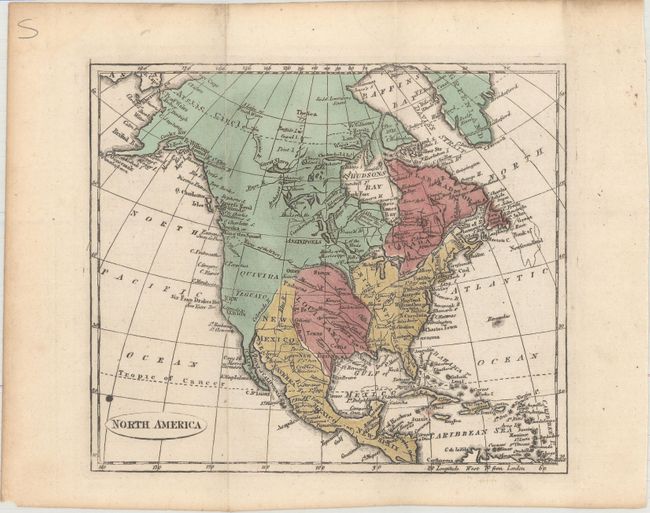
A. North America, by Anonymous, circa 1808 (8.1 x 7.0"). This small map of North America shows the United States confined to east of the Mississippi River with a speculative River of the West ending at the Entrance Juan de Fuca. Alaska is somewhat misshapen but coming into form, and only a handful of place names are identified along the western coast of present-day United States. Condition: Issued folding with a small ink spot above the title cartouche. (B+)
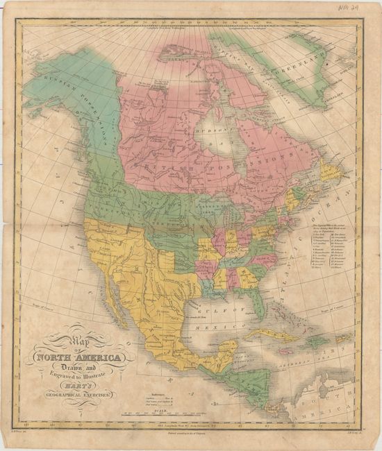
B. Map of North America Drawn and Engraved to Illustrate Hart's Geographical Exercises, by James H. Young, from Hart's Geographical Exercises, circa 1828 (12.6 x 14.9"). This map shows the United States' border extending well north into present-day British Columbia while Mexico is in control of Texas and the southwest. The western half of the United States is dominated by Oregon and Missouri territories, while Wisconsin and parts of Minnesota are labeled Northern Territory. The states and settled territories are ranked by population in a table at right. Condition: Scattered foxing with a 2" centerfold separation near the middle of the map image. (B)
References:
Condition:
See description above.