Subject: Western Hemisphere - America
Period: 1813 (dated)
Publication: New General Atlas
Color: Hand Color
Size:
20.3 x 18.1 inches
51.6 x 46 cm
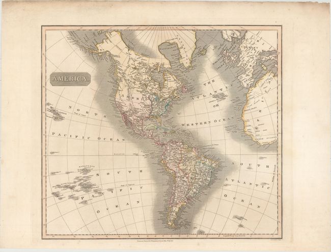
In Thomson's style, this well engraved map shows the latest discoveries including those of Mackenzie, Hearne, and Lewis & Clark. The map extends to include the coasts of Europe and West Africa, and it presents good detail of islands in the eastern portion of the South Pacific. The United States is shown north of East and West Florida, and east of the Mississippi River. The land west of the Mississippi is called Louisiana and the northwest portion of the continent is largely devoid of detail. Hawaii is named Sandwich Isles. Engraved by J. & G. Menzies.
References: Phillips (Atlases) #731-52.
Condition: A
Light soiling in the top blank margin, else fine.