Prevost's Volume Featuring Maps of the Arctic Region
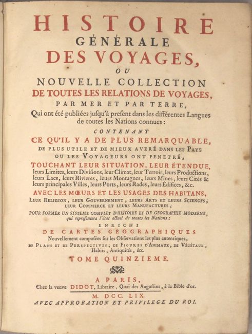
"Histoire Generale des Voyages, ou Nouvelle Collection de Toutes les Relations de Voyages ... Tome Quinzieme", Prevost, Anton Francois
Subject: Exploration & Surveys, Arctic, North America, Lesser Antilles
Period: 1759 (published)
Publication:
Color: Black & White
Size:
8 x 10.3 inches
20.3 x 26.2 cm
This is a very nice example of volume fifteen of Prevost's history of voyages, with maps by Jacques Nicolas Bellin. This volume focuses on the discoveries in northern North America and the Arctic regions as well as the Lesser Antilles. There are a total of seventeen maps (9 northern regions, 8 Lesser Antilles) and include the following titles:
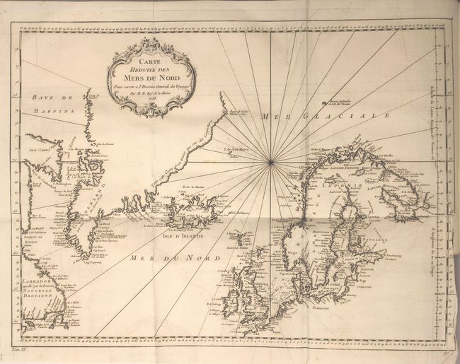
Carte Reduite des Mers du Nord... (17.8 x 13.1"). This nice chart is centered roughly on Iceland and covers from the eastern shores of Canada through Greenland to Scandinavia and Britain. The coastlines are intricately drawn with coastal place names the only detail. Condition: There is a 4.5" binding tear at right that is closed on verso with archival tape.
Carte du Detroit de Waeigats ou de Nassau Suivant les Navigateurs Hollandois… (11.8 x 7.7"). A boldly engraved copperplate map that is centered on the Russian islands of Novaya Zemlya and Pechorskaya Guba, here Nouvelle Zemble and Grande Baye. The detailed chart shows the lower part of the island and mainland.
Partie de la Mer Glaciale Contenant la Nouvelle Zemble et le Pais des Samoiedes ... (13.8 x 8.5"). This map features Novaya Zemlya, the island off northern Russia in the Barents Sea, and extends to about Dikson in the east. Embellished with rhumb lines and a decorative cartouche.
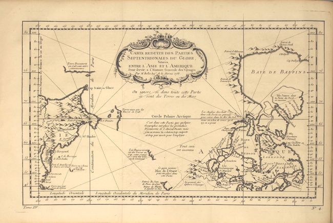
Carte Reduite des Parties Septentrionales du Globe, Situees Entre l'Asie et l'Amerique ... (13.7 x 8.3"). Very unusual chart that shows only the northeast coastline of Canada with Baffin and Hudson Bay and the St. Lawrence River. On the other side is the northeast coastline of Asia with the Kamchatka peninsula. In between are a few small areas of coastline with notations concerning reported explorations, including those of Juan de Fuca, the Russian expeditions in 1728 and 1741, the reported Sea of the West and the English quests for a Northwest Passage via the Hudson Bay.
Carte du Spits-Berg Suivant les Hollandois... (11.9 x 8.6"). Copper engraved map of Spitsbergen (Svalbard) with the adjacent islands of Franz Josef Land and Jan Mayan. There is good detail of the rocks, shoals, regions of ice, and anchorages with notations concerning discoveries and explorations.
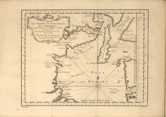
Carte des Parties du Nord-Ouest de l'Amerique Suivant les Voyages de Middleton et d'Ellis en 1742 et 1746 pour Chercher un Passage dans la Mer du Sud (10.8 x 8.3"). Condition: Light creasing adjacent to the left fold.
Carte du Golphe de Bothne... (single page).
Suite du Golphe de Bothne... (single page).
Carte des Environs de Tornea... (single page).
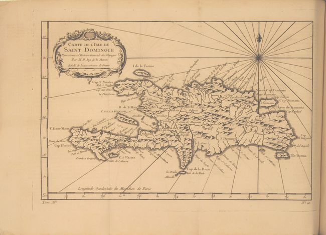
Carte de l'Isle de Saint Domingue... (11.6 x 7.6"). This copper-engraved map of Hispaniola names several capes, ports, and bays running along the coast of the island, as well as identifying numerous towns and rivers inland. A compass rose capped with a fleur-de-lis radiates rhumb lines and a title cartouche draped in garlands adorns the upper left corner.
Carte de de l'Isle St. Christophle... (12 x 7.6"). This lovely map of St. Kitts is fully engraved with mountains, rivers, lakes, and towns. The island has twelve quarters and parishes, which are sometimes indicated by hand coloring, but not on this example. In the center of the island a note on the mountain Mont Misery locates Mines de Souffre. Grande Saline, Ville de la Basse Terre, forts, churches and more are identified.
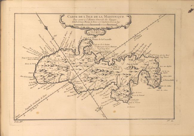
Carte de l'Isle de la Martinique... (12 x 7.9"). Delicately detailed map of the island showing mountains, roads, towns, forts, anchorages, and dozens of place names. Exhibiting fine coastal detail, the chart locates Sac Marin, Bourg de la Rivieree Pilote, Se. Luce, Fort Royal, Fort S. Pierre, the Pitons du Vauclain, roads, watershed, graphic topography, shoals, and anchorages.
Carte de l'Isle de la Guadeloupe... (12.1 x 8.3"). A very handsome, small map adorned with rhumb lines, fleur-de-lys, and two decorative rococo-style cartouches. Filled with good detail and place names throughout. Also includes the islands of Mari-Galante, Terre d'Enhaut, and Terre d'Enbas. Condition: Light toning.
Carte de l'Isle de la Grenade... (single page). Condition: Light toning.
Carte de l'Isle de Sainte Lucie... (11.8 x 7.5"). The island of St. Lucia is divided into the region controlled by the native Caribs and the colonial sugar plantations. Scores of anchorages surround the island and topographical features are shown inland as is the long road. Old Fort Francois is located, but no town or village is depicted.
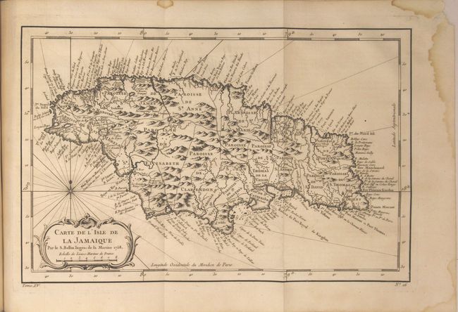
Carte de l'Isle de la Jamaique... (12.6 x 6.3"). Strongly engraved map describing this island of the Greater Antilles. Divided by parishes, the map shows remarkable detail with scores of place names along the coast plus mountains, personal estates, watershed and other details in the interior.
Carte de l'Isle de la Barbade... (single page).
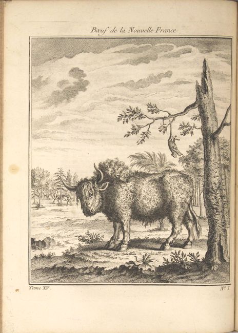
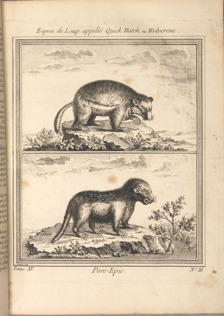
Published by Didot, the book is in full leather with gilt title and raised bands on spine. Quarto, vij, 718 pp., 17 copper-engraved maps and 11 additional plates including several interesting depictions of animals and a sugar mill.
References:
Condition: B+
The maps are mostly near fine with faint offsetting. See description for additional details on specific maps. Text is clean and bright with occasional light toning and a few spots of foxing. Covers are lightly worn with bumped and chipped edges, and there is a small chip on the back cover into the head of the spine.