Subject: Geography Books
Period: 1795 (published)
Publication:
Color: Black & White
Size:
4.5 x 7 inches
11.4 x 17.8 cm
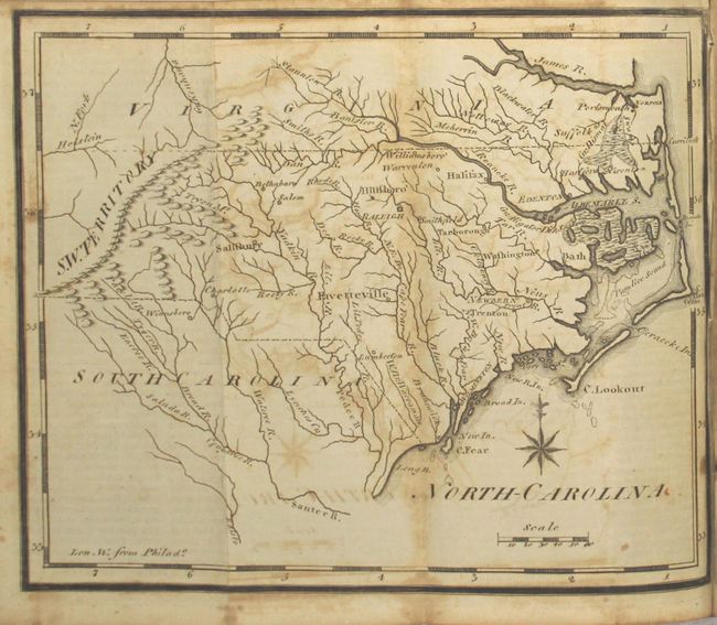
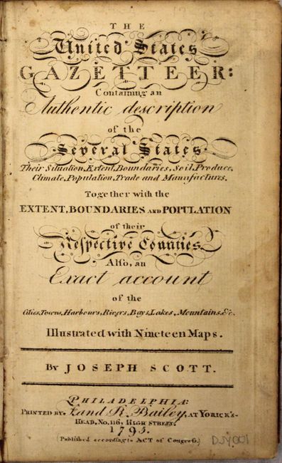
Joseph Scott was a Philadelphia engraver and publisher who engraved a number of important early state maps for Matthew Carey, a fellow Philadelphian. In 1795, Scott published the first Gazetteer of the United States containing 19 maps of the United States and its territories. Scott engraved all of the maps, as he explains in his preface: "The maps I have drawn and engraved myself, and I trust they will be found, on examination, as accurate as circumstances would admit, and probably more so than any collection of maps that has hitherto been published in the United States." His maps represent some of the earliest published maps of individual states and the western territory, and were drawn, of course, with Philadelphia as the prime meridian. The associated text includes substantive information on the young Republic, with details on the history, geography, natural history, architecture, and more of individual states and regions. This example contains 17 (of 19) maps: Connecticut, Delaware, Georgia, New Jersey, Kentucky, Maine, Massachusetts, New Hampshire, New York, North Carolina, Pennsylvania, Rhode Island, South Carolina, N.W. Territory, S.W. Territory, Vermont, Virginia. The two missing maps are Maryland and the United States.
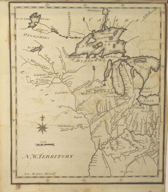
The map N.W. Territory is the earliest printed map to show the North West Territory. It covers the region of the upper Mississippi Valley and the Great Lakes, and shows the rivers and streams together with settlements, mines, and forts. Lit. Fort appears at the mouth of the Chicago River, and Old Ft. Orleans appears on the Missouri River. The southern end of Lake Michigan is placed almost a full degree further north than the southern shore of Lake Erie, an error that resulted in a series of boundary disputes between Michigan and its neighbors in the 19th century. The fictitious Charlevoix-Bellin islands appear in Lake Superior. This is the first state with small, plain circle icons to locate the towns like Detroit and Sandusky.
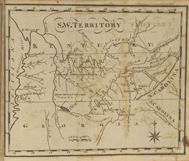
The map S.W. Territory is the first state; later states of this map change the title to "Tennassee." While simply drawn, the map includes interesting information including the locations of early settlements, military reservations, and Indian villages. The Mero district is located and divided into three counties: Sumner, Davidson, and Tennassee. Nashville is here called Naskville. Fort Massac is shown on the Ohio River, and there is a note near Knoxville describing the way to Pensacola as being nearly level. The map includes a portion of the adjoining states of Kentucky and Georgia.
17 (of 19 maps); title page; iii-vi; errata; 292 pp. (unpaginated). 12mo, original full calf with black morocco label and gilt titling on spine.
References: Howes #S237; Ristow, p. 154; Sabin #78331; Wheat & Brun #125.
Condition: B
The majority of the maps have moderate offsetting and light foxing, although a few have only light offsetting (Delaware, New Jersey, Kentucky, Maine & New Hampshire). The map of South Carolina also has heavy soiling along one fold, and the map of Virginia has two large spots. The text has light toning, offsetting, and scattered foxing. The hinges are starting and the covers and spine are moderately worn and rubbed, with bumped corners and some cracking along the spine. There are some pencil markings on the pastedowns and a bookstore stamp on the verso of the title page.