Subject: Atlases
Period: 1818 (dated)
Publication:
Color: Black & White
Size:
5.5 x 8.7 inches
14 x 22.1 cm
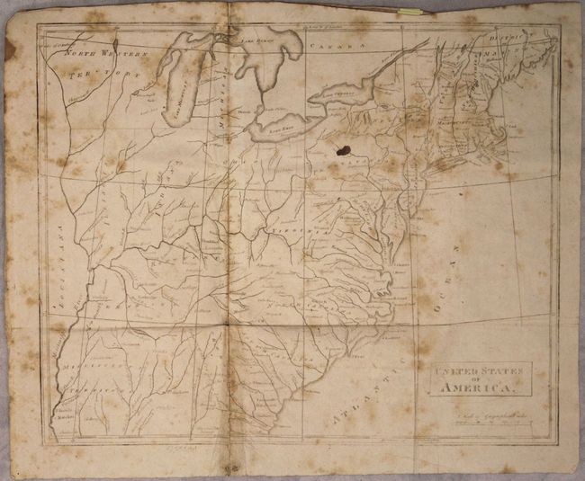
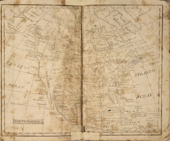
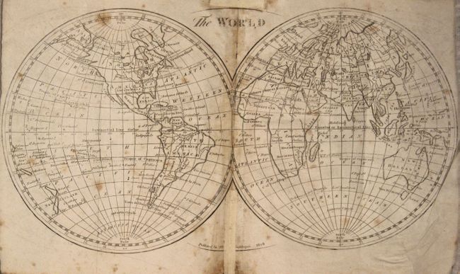
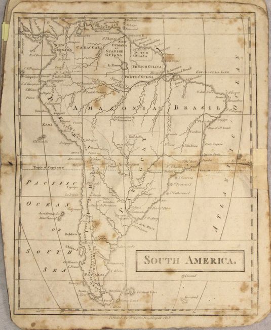
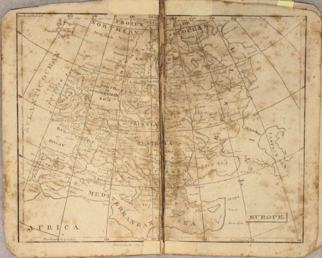
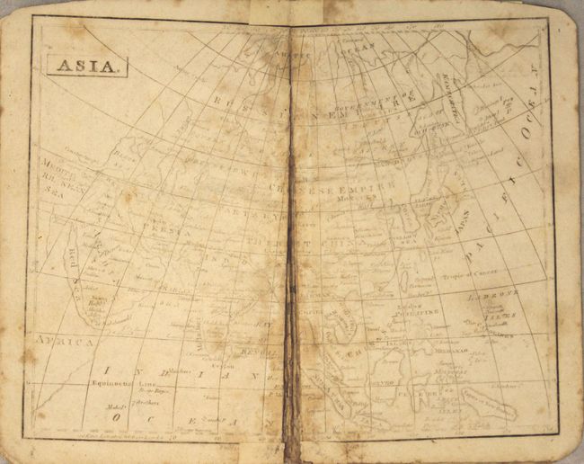
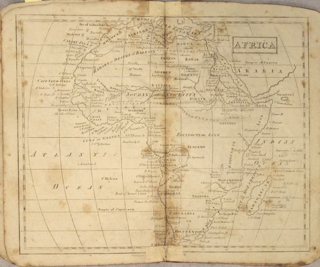
This early, untitled school atlas was published by Paracette Potter and likely produced for Willetts' Geography. It contains seven maps (5 double-page, 2 folding) of the world and continents. The map of North America shows the United States confined east of the Mississippi River, Louisiana occupying the central plains region, and New Mexico incorporating Texas. Several western rivers hint at possible passages to the Pacific. The atlas also contains an early map of the United States that features a large Mississippi Territory, North Western Territory, and the new state of Illinois. Bound in original stiff paper covers. See below for specific map condition statements:
The World (14 x 8.5"). Scattered foxing with centerfold separations in the top and bottom blank margins that have been closed on recto with old paper.
North America (9.7 x 7.9"). Moderate foxing with a completely separated centerfold that has been partially closed on recto in the blank margins.
United States (12.5 x 10.2"). Scattered foxing with a 3" fold separation at bottom closed on verso with old paper.
South America (7.9 x 9.8"). Scattered foxing with a short fold separation at right closed on recto with old paper.
Europe (9.7 x 7.9"). Moderate foxing with a completely separated centerfold.
Asia (9.7 x 7.9"). Light foxing with a completely separated centerfold.
Africa (9.7 x 7.9"). Light foxing with centerfold separations in the top and bottom blank margins that have been closed on recto with old paper.
References:
Condition: C+
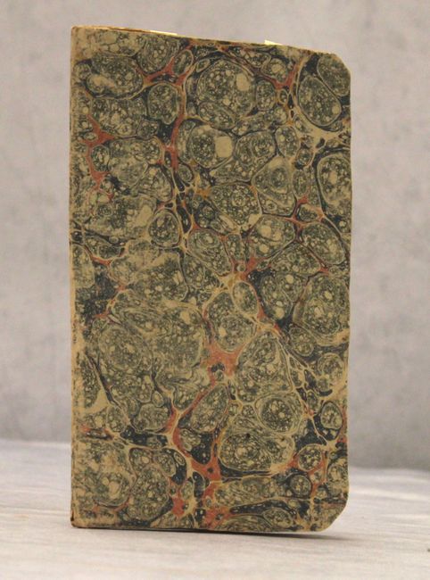
See description above for map details. Stiff paper covers are moderately worn.