Catalog Archive
Auction 159, Lot 686
"Carte de l'Isle Madagascar dite Autrement Madecase et de S. Laurens...", Duval, Pierre
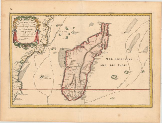
Subject: Madagascar
Period: 1677 (dated)
Publication: Cartes de Geographie les Plus Nouvelles et les Plus Fideles…
Color: Hand Color
Size:
21.9 x 14.6 inches
55.6 x 37.1 cm
Download High Resolution Image
(or just click on image to launch the Zoom viewer)
(or just click on image to launch the Zoom viewer)