Subject: China, Korea & Japan
Period: 1711 (circa)
Publication: Introductio in Universam Geographiam
Color: Hand Color
Size:
9.9 x 8.1 inches
25.1 x 20.6 cm
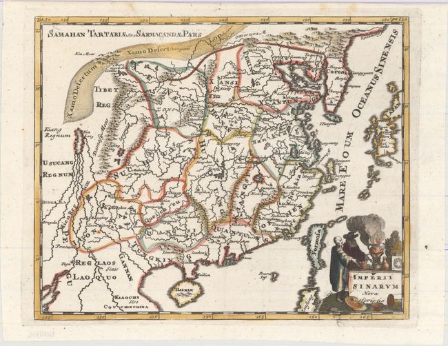
Handsome small map based on the important Martini/Blaeu map of the Chinese Empire. It shows a fair number of provinces and cities named in the interior. The Great Wall is depicted along the northern border. A large fictitious interior lake labeled Kia Lacus is the source of five large, southern rivers. The map extends to include Formosa, Korea and parts of Japan and Laos. The title cartouche depicts a Jesuit with a Chinese nobleman and warrior and a large incense pot.
Cluver's Introductio in Universam Geographicam was a popular atlas, appearing in over 45 editions during a 100-year period. The first edition was published without maps in the 1620s, and the first edition to include maps was published circa 1641. The various editions were published in different cities throughout Europe, including Amsterdam, Nuremberg, and London. This map is from a London edition, with the majority of the maps re-engraved by John Senex.
References: Shirley (BL Atlases) T.CLUV-9a #36.
Condition: A
An excellent impression with one small rust spot at bottom left.