Catalog Archive
Auction 159, Lot 628

"Asia According to the Sieur d'Anville, Divided into Its Empires Kingdoms & States, Shewing the European Settlements in the East Indies, and All the New Discoveries, Made by the Russians the Dutch and the English", Sayer, Robert

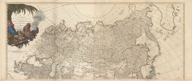
Subject: Northern Asia

Period: 1772 (dated)

Publication:

Color: Hand Color

Size:
47.1 x 20.3 inches
119.6 x 51.6 cm
Download High Resolution Image
(or just click on image to launch the Zoom viewer)

These are the upper two sheets of the superb, four-sheet map based on the cartography of the famous French cartographer Jean Baptiste Bourguignon d' Anville. It provides an extremely detailed view of the northern part of the continent. While Kamchatka is represented relatively accurately, there is still imprecision in the North Asian coast. The Russian discoveries appear in the vicinity of Alaska, and the Dutch discoveries are shown in the region north of Japan. The Sea of Japan is labeled as the Gulf of Corea. There is a large decorative cartouche at left that features an Asian merchant, his exotic goods, and a camel. The sheets are joined.

References:

Condition: B+

A fine impression on watermarked paper with light scattered foxing that is more prominent on the eastern sheet, minor offsetting, and a few extraneous creases. A fold separation at bottom left has been closed on verso with old paper.

Estimate: $400 - $475

Sold for: $200

Closed on 9/14/2016

Archived