Subject: Arabia, Red Sea, East Africa
Period: 1720 (circa)
Publication:
Color: Hand Color
Size:
29.3 x 20.3 inches
74.4 x 51.6 cm
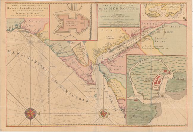
This is Gerard van Keulen's edition of this impressive sea chart covering the Red Sea and the Gulf of Aden with portions of Yemen and the east coast of Africa from modern Tanzania to Suez. The coasts of Egypt and Saudi Arabia are shown, with Jeddah (Gida vel Giodda) and Mount Sinai identified. There are four inset maps, depicting Fort Mombassa, Mombassa Island, the island of Socotra, and the coastline of Perim (Babel Mandel). Bab-el-Mandeb is prominent in the seaway between the southern Red Sea and the Gulf of Aden, and Zanzibar also appears, with many names along the coast. The map is oriented with north to the right by two spectacular compass roses. There are two title cartouches, one presenting the title in French and the other in Dutch.
References: cf. Norwich #262.
Condition: B+
Issued folding on a sturdy and lightly toned sheet with minor scattered foxing and a small separation at bottom.