Subject: North Sea
Period: 1715 (circa)
Publication: Atlas de la Navigation et du Commerce
Color: Hand Color
Size:
23.1 x 18.6 inches
58.7 x 47.2 cm
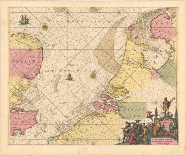
This handsome coastal chart taken from plates engraved for Frederick de Wit's maritime atlas details the North Sea between England and the Netherlands. The Frisian Islands are shown along the coast of Holland to just south of Dunkerque. The English coast is more generally described, but the sea is full of rhumb lines, soundings, a compass rose, and sailing ships. There is a decorative cartouche at bottom right that has figures representing the natives of the Dutch colonies trading with a representative of the Dutch East India Company.
First published circa 1675, de Wit's sea atlas, Orbis Maritimus ofte Zee Atlas, contained 27 charts from the North Pole to North and South America. The charts all appear to have been engraved by Romain de Hooghe and are splendid examples of Dutch marine works. The atlas was reprinted with amendments by Louis Renard in 1715, by Reinier and Josua Ottens in 1739 and 1745, and finally by the widow of van Keulen in 1802.
References: Shirley (BL Atlases) M.REN-1a.
Condition: A
A sharp impression in original color with minor soiling and a short separation in the bottom blank margin.