Subject: Southern United States, Mexico & Central America
Period: 1798 (dated)
Publication: Nuovo Atlante Geografico Universale
Color: Hand Color
Size:
13.7 x 19.1 inches
34.8 x 48.5 cm
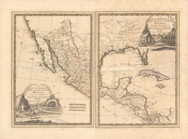
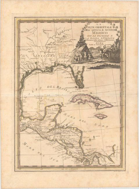
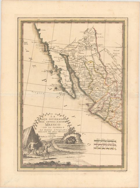
This matching set of maps each have their own title cartouches and borders, but combine to create an impressive map of the southern United States, Mexico and Central America. Each map includes a striking pictorial cartouche, featuring a Native American family defending themselves from a pair of leopards on the western sheet and Spanish Conquistadors on horseback arriving in an Indian village on the eastern sheet.
The eastern sheet shows the extensive river system in the southern US, although the Mississippi River is not connected to the Missouri River. A number of place names are given, including Cenis in Texas, New Orleans, and Biloxi. Florida is still shown as an archipelago.
The western sheet depicts the headwaters of the Rio Grande in the northern extent of the map with many of the Hopi Pueblos located. The Colorado is shown, with the Gila River (Hila F) more or less properly delineated. Numerous Indian tribes are located including the Yuma, Coco Maricopa and Apache. San Diego and the Channel Islands are shown and a large bay in northern California is labeled S. Carlos (San Francisco Bay?). The map is filled with place names, including many of the missions in the Southwest and S. Antonio Besar in Texas.
References:
Condition: B
Original outline color on watermarked paper with light toning and staining.