"New Agricultural and Highway Map of Oklahoma", Geographical Publishing Co.
Subject: Oklahoma
Period: 1922 (circa)
Publication:
Color: Printed Color
Size:
20.5 x 15.2 inches
52.1 x 38.6 cm
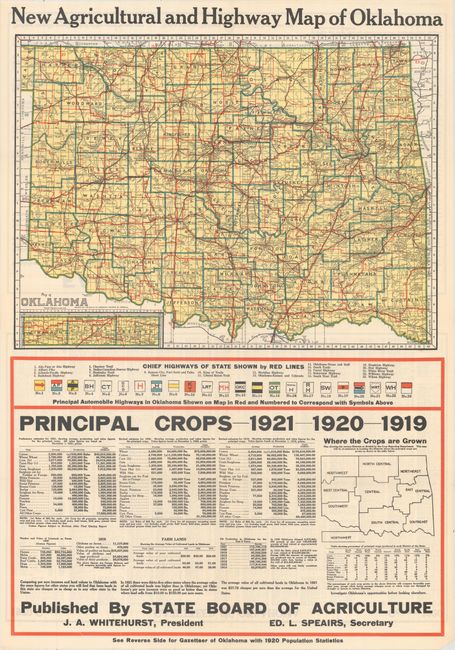
This promotional map of the state is delineated by county and depicts a network of roads in red which are keyed to a table revealing 23 different highway names. Below the map, the state's key crops are listed over the prior three years with the value of crops dropping significantly from $60.5 million in 1919 to $17.6 million in 1921. The dramatic decline in commodity prices coincided with the end of World War I, when Europe no longer needed U.S. food supplies. A mitigating note below this table states that the agricultural incomes and land values in Oklahoma "are cheaper or as cheap as in any other state in the Union." The verso contains an index and "Facts About Oklahoma" including one that states "there may be a better country with brighter opportunities than Oklahoma offers, but a lot of us are from Missouri - you will have to show us." Published by the State Board of Agriculture.
The full sheet with statistical table measures 21.1 x 30.3".
References:
Condition: A
A clean and bright example with one tiny split at a fold intersection. Issued folding.