Subject: New York City, New York
Period: 1886 (dated)
Publication: Atlas des Ports Etrangers
Color: Printed Color
Size:
23.9 x 18.1 inches
60.7 x 46 cm
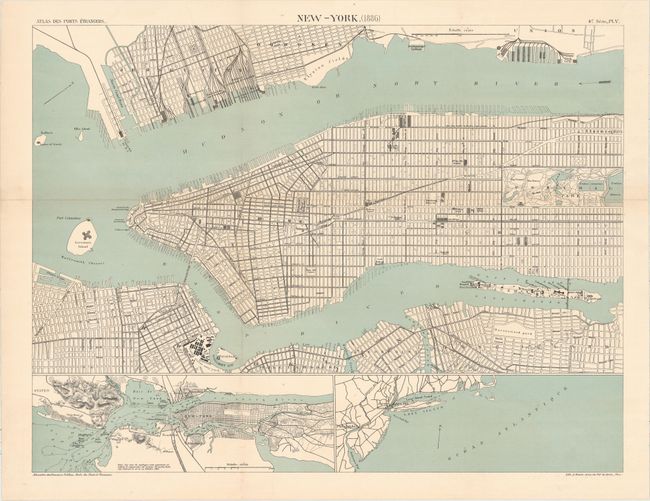
This French atlas map centers on Manhattan, depicted from Central Park to its tip. It extends to show Jersey City, Hoboken, Governor's Island, Roosevelt Island (still Blackwell Island here), Ellis Island, and parts of Brooklyn and Long Island. The streets are laid out in plan form, with notable locations like Bellevue Hospital, the Statue of Liberty, Union Square, and the Brooklyn Navy Yard. Inset maps at bottom zoom out for a wider view of the city and its surroundings with navigational information (left) and to depict a larger portion of the Mid-Atlantic coast. Lithography by A. Simon.
References:
Condition: B
Issued folding with a horizontal fold separation running the length of the map that has been closed with archival materials and minor toning along that fold.